Rockd
University of Wisconsin-Madison Shared Apps
4.4 ★
store rating
Free
With this geologic app, you can access maps, log observations, and explore landscapes in 3D. Includes geologic summaries, offline map caching, and user contribution features.
AppRecs review analysis
AppRecs rating 4.2. Trustworthiness 78 out of 100. Review manipulation risk 21 out of 100. Based on a review sample analyzed.
★★★★☆
4.2
AppRecs Rating
Ratings breakdown
5 star
73%
4 star
9%
3 star
8%
2 star
2%
1 star
8%
What to know
✓
Low review manipulation risk
21% review manipulation risk
✓
Credible reviews
78% trustworthiness score from analyzed reviews
✓
High user satisfaction
82% of sampled ratings are 4+ stars (4.4★ average)
About Rockd
Explore, learn about, and document your geologic surroundings! Whether you are a professional geoscientist or curious about the rocks around you and the stories they tell, Rockd allows you to explore and learn about the geologic record, contribute your own observations, and log your journey through the geologic record.
Features:
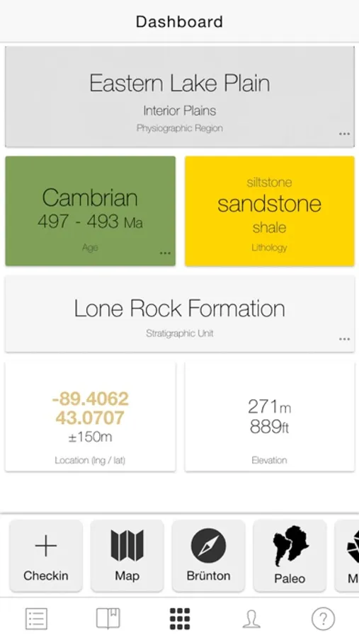
- Instant access to geologic and geographic summaries of your current location via a Dashboard
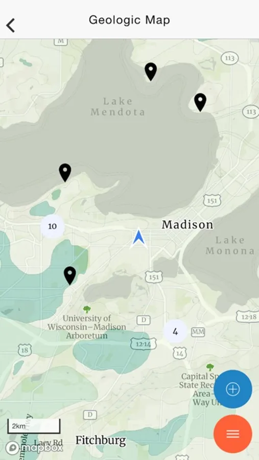
- Interactive global access to more than 290 geologic maps, with more being added weekly
- Explore the landscape with a dynamic, 3D virtual globe
- Save maps for use in the field with a built-in map caching system
- See your past location and explore paleogeographic maps from C.R. Scotese and GPlates
- View Macrostrat stratigraphic columns where available (beta)
- Explore published literature containing mentions of mapped geologic units (when available) via xDD (formerly, GeoDeepDive)
- Elevation data for most points on Earth from digital elevation models (DEMs)
- Add your own field observations even offline; tag features from Macrostrat and the Paleobiology Database
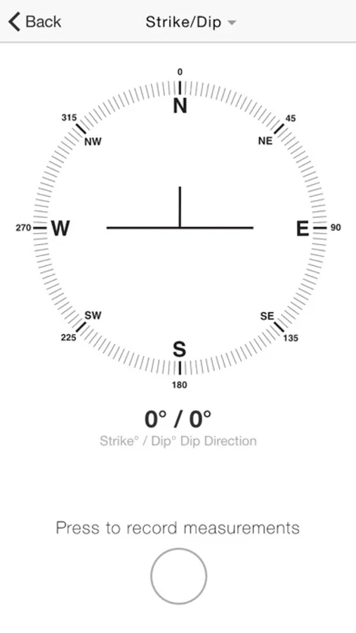
- Record strike/dip or trend/plunge for geologic features, using your phone's compass
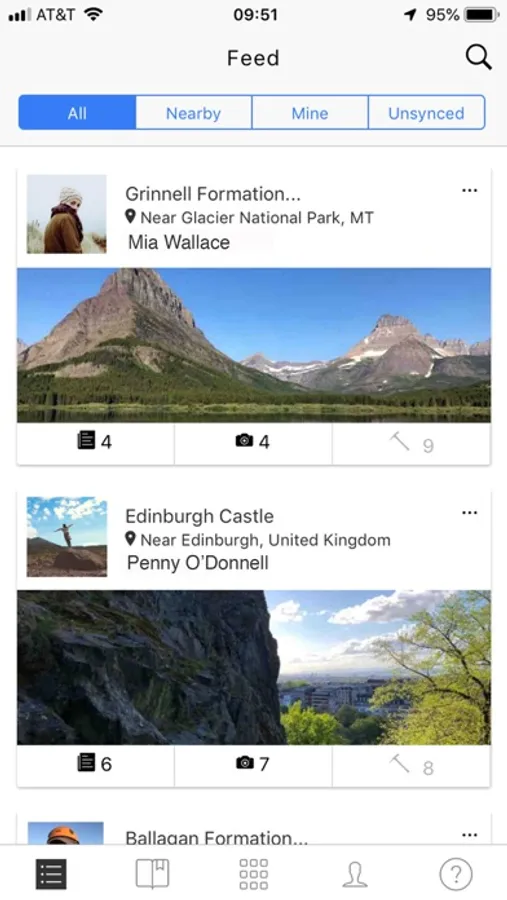
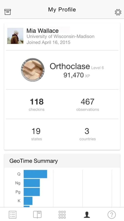
- Track your progress through the geologic record privately, or share it with others
- See the public activity of other users and share your own and other public checkins using unique URLs
Rockd is produced by the Macrostrat lab in the Department of Geoscience at the University of Wisconsin - Madison. Support provided by the National Science Foundation (NSF) and the Dept. of Geoscience.
Experiencing issues? Send an email to contact@rockd.org and we will do our best to help you resolve it.
Features:
- Instant access to geologic and geographic summaries of your current location via a Dashboard
- Interactive global access to more than 290 geologic maps, with more being added weekly
- Explore the landscape with a dynamic, 3D virtual globe
- Save maps for use in the field with a built-in map caching system
- See your past location and explore paleogeographic maps from C.R. Scotese and GPlates
- View Macrostrat stratigraphic columns where available (beta)
- Explore published literature containing mentions of mapped geologic units (when available) via xDD (formerly, GeoDeepDive)
- Elevation data for most points on Earth from digital elevation models (DEMs)
- Add your own field observations even offline; tag features from Macrostrat and the Paleobiology Database
- Record strike/dip or trend/plunge for geologic features, using your phone's compass
- Track your progress through the geologic record privately, or share it with others
- See the public activity of other users and share your own and other public checkins using unique URLs
Rockd is produced by the Macrostrat lab in the Department of Geoscience at the University of Wisconsin - Madison. Support provided by the National Science Foundation (NSF) and the Dept. of Geoscience.
Experiencing issues? Send an email to contact@rockd.org and we will do our best to help you resolve it.