With this app, you can create, share, and plan hunting grounds using maps, borders, and pins. Includes real-time location sharing, chat, weather updates, and GPS tracking for dogs.
AppRecs review analysis
AppRecs rating 4.6. Trustworthiness 0 out of 100. Review manipulation risk 0 out of 100. Based on a review sample analyzed.
★★★★☆
4.6
AppRecs Rating
Ratings breakdown
5 star
73%
4 star
13%
3 star
13%
2 star
0%
1 star
0%
What to know
✓
High user satisfaction
73% of sampled ratings are 5 stars
About WeHunt
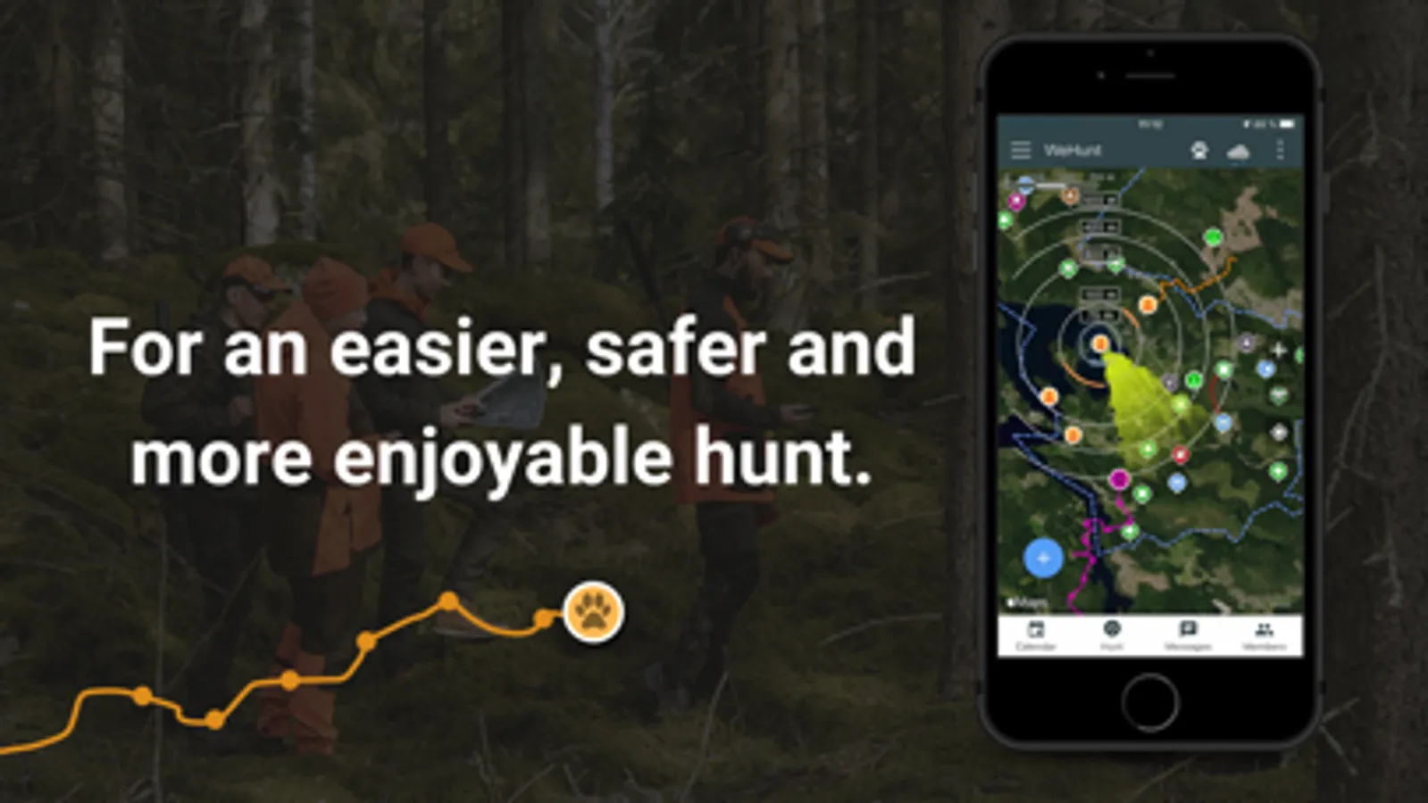
In WeHunt you will find everything you possibly need for a successful hunt. Through pinpoint accurate maps, advanced planning tools and real-time positioning updates it makes the hunt easier and safer for you, your dogs and your hunting companions. Plus by staying connected and on top of every movement your time in nature will be much more enjoyable. It’s simply an invaluable tool, no matter what kind of hunt you are conducting. Join 800,000 hunters for free on WeHunt today.
Simple
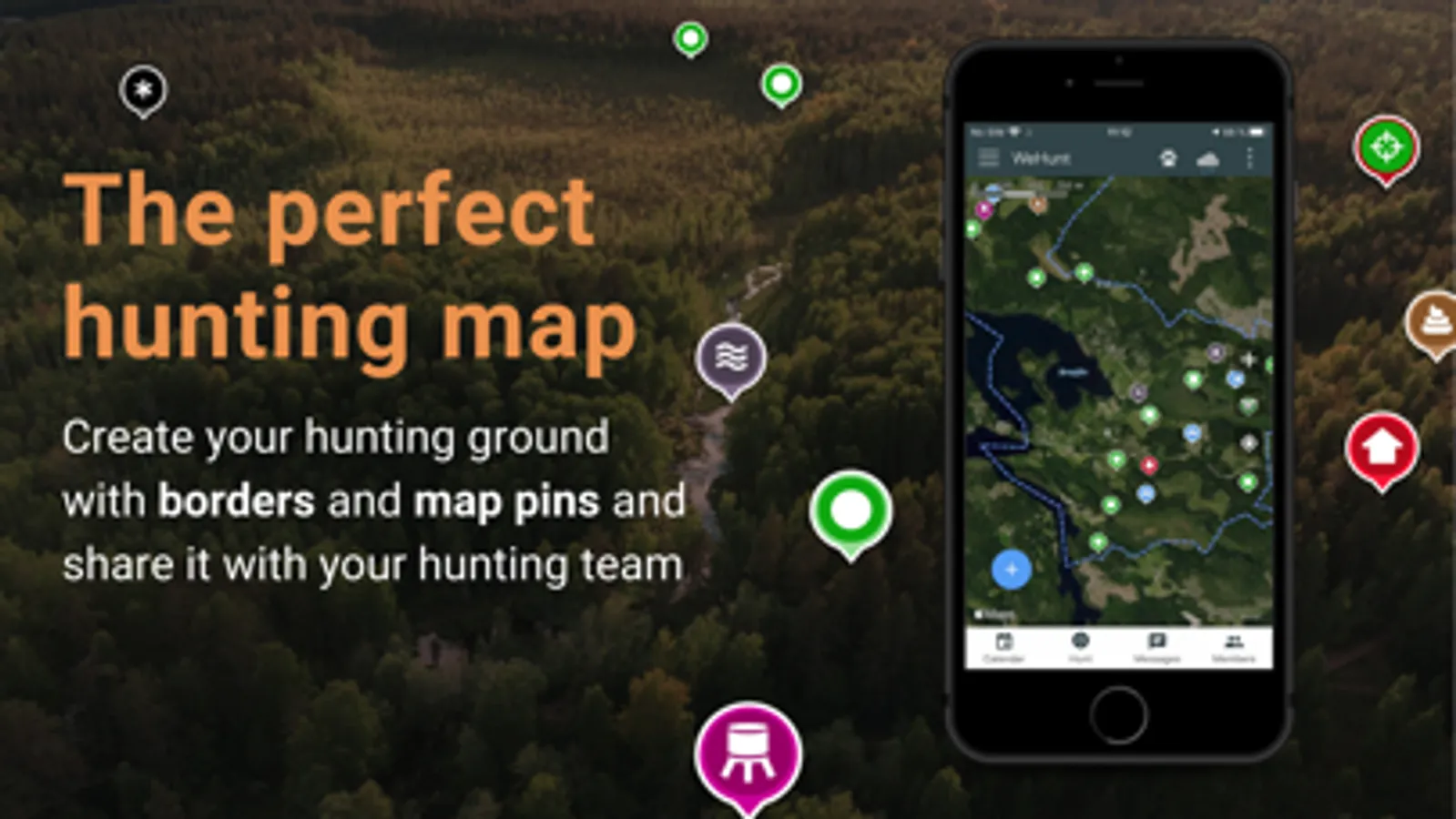
Simplify the hunt by creating and saving your hunting ground with borders and map pins such as high stands, gathering places and tracks. Share grounds with your hunting companions and lay out the plan.
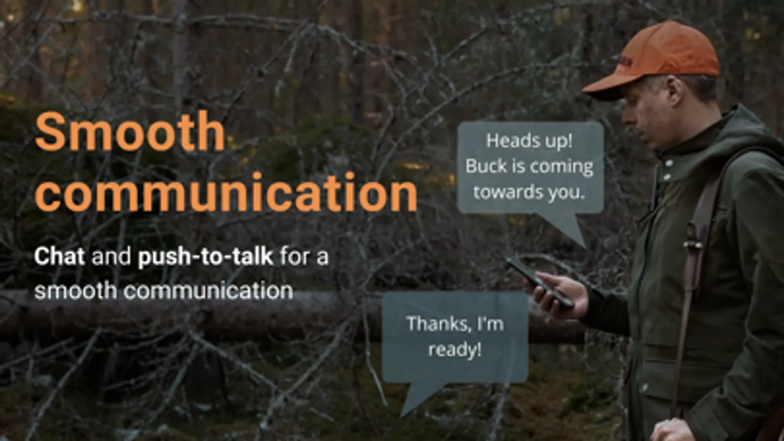
Safe
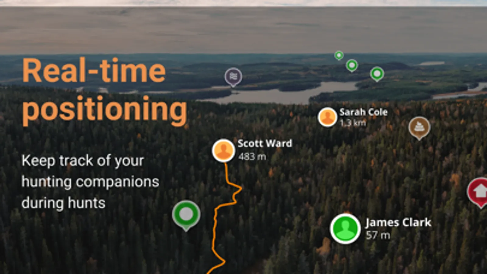
When you start a hunt you will see your hunting companions live on the map - as well as also participating dogs - all for a safer hunt. Chat and send voice messages to each other to draw attention to key events or call for assistance.
Map
All hunters want the best maps. With WeHunt Standard, you get Terrain Map worldwide. Print the map in paper format via both the app and the web if you wish.
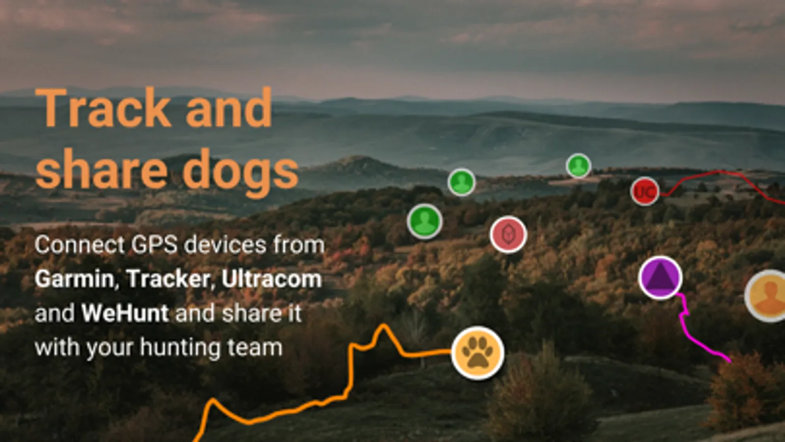
Keep track of dogs
With a WeHunt GPS, Tracker, Ultracom or Garmin device (accessory) you can see and share your dog’s position on the map while hunting.
And so much more
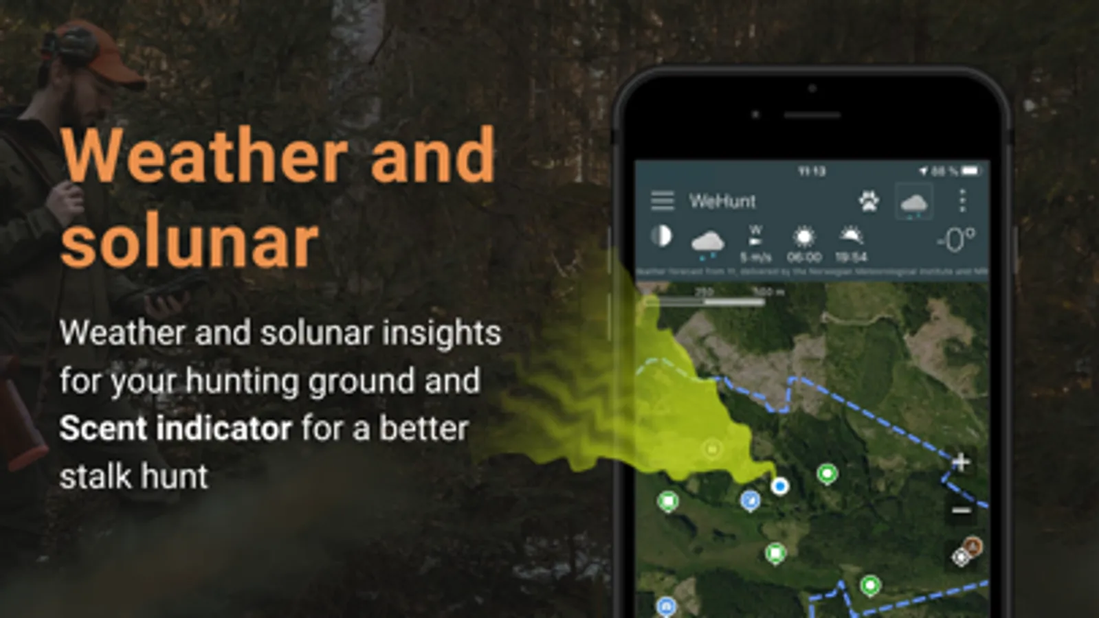
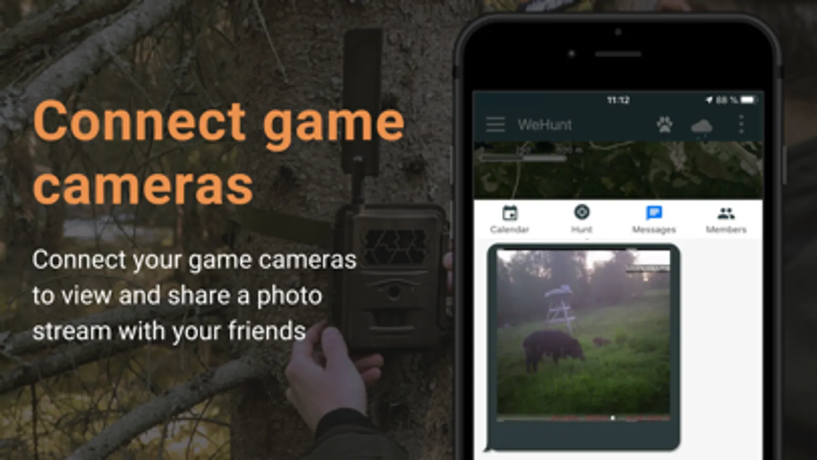
WeHunt contains many additional functions to improve your hunting experience. Keep track of the weather and wind on your hunting ground and use the Scent Indicator to see the wind from your position. Connect game cameras to see all pictures in one easy overview, record your tracks on the hunting grounds, and collect statistics in hunt reports.
Try it today for free to see how WeHunt can make your hunt easier, safer and more enjoyable.
- Note that continued use of GPS running in the background can dramatically drain battery. By "checking in" to your assigned post you can reduce data sent and battery usage.
- Contains map data from Danish Styrelsen for Dataforsyning og Effektivisering (Kort25, WMS-service and property borders, WMS-service), Norwegian Kartverket, Finnish Lantmäteriverket, and Swedish Lantmäteriet.
End user license agreement: https://www.apple.com/legal/internet-services/itunes/dev/stdeula/
Simple
Simplify the hunt by creating and saving your hunting ground with borders and map pins such as high stands, gathering places and tracks. Share grounds with your hunting companions and lay out the plan.
Safe
When you start a hunt you will see your hunting companions live on the map - as well as also participating dogs - all for a safer hunt. Chat and send voice messages to each other to draw attention to key events or call for assistance.
Map
All hunters want the best maps. With WeHunt Standard, you get Terrain Map worldwide. Print the map in paper format via both the app and the web if you wish.
Keep track of dogs
With a WeHunt GPS, Tracker, Ultracom or Garmin device (accessory) you can see and share your dog’s position on the map while hunting.
And so much more
WeHunt contains many additional functions to improve your hunting experience. Keep track of the weather and wind on your hunting ground and use the Scent Indicator to see the wind from your position. Connect game cameras to see all pictures in one easy overview, record your tracks on the hunting grounds, and collect statistics in hunt reports.
Try it today for free to see how WeHunt can make your hunt easier, safer and more enjoyable.
- Note that continued use of GPS running in the background can dramatically drain battery. By "checking in" to your assigned post you can reduce data sent and battery usage.
- Contains map data from Danish Styrelsen for Dataforsyning og Effektivisering (Kort25, WMS-service and property borders, WMS-service), Norwegian Kartverket, Finnish Lantmäteriverket, and Swedish Lantmäteriet.
End user license agreement: https://www.apple.com/legal/internet-services/itunes/dev/stdeula/