AppRecs review analysis
AppRecs rating 5.0. Trustworthiness 0 out of 100. Review manipulation risk 0 out of 100. Based on a review sample analyzed.
★★★★★
5.0
AppRecs Rating
Ratings breakdown
5 star
100%
4 star
0%
3 star
0%
2 star
0%
1 star
0%
What to know
✓
High user satisfaction
100% of sampled ratings are 5 stars
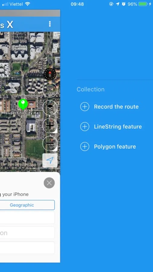
About iGeoTrans X
iGeoTrans X is a cloud app on the smartphone, designed to address common problems for fieldwork researchers hoping to use smartphones ad the field as GPS/GIS & Data collection devices.
___________________
What can you do with iGeoTrans X:
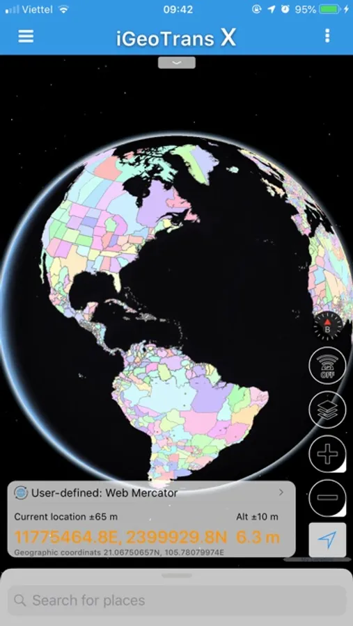
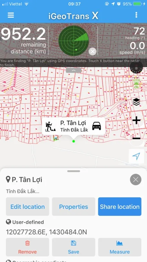
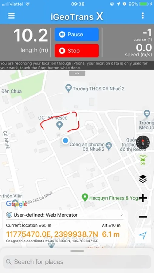
- Record the route from a specific location to the site surveys and display on the map.
- Measure the distance between two specific locations by coordinates or selected on the map.
- Measure the area of a region according to the coordinates list or selected on the map.
- Take the photo with GPS coordinates.
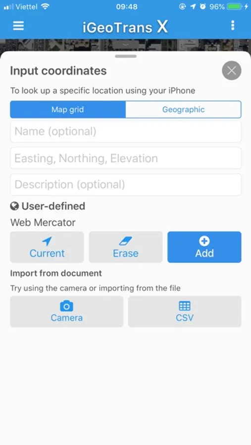
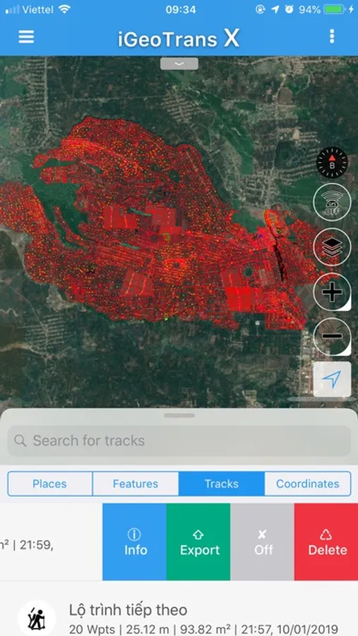
- Create Markers, Polyline, Polygon using GPS positioning, or import from coordinates file.
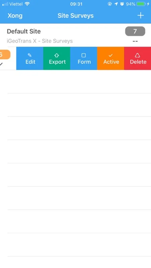
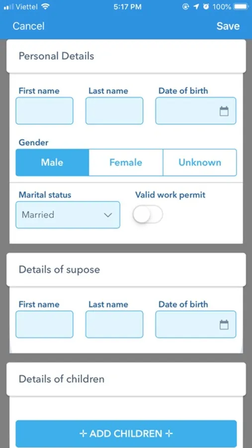
- Create the geographic object (Features) using Point, LineString, and Polygon with custom forms to enter attribute data.
- Synchronize data between different devices via your iCloud account.
- Export data in popular formats to share with other software.
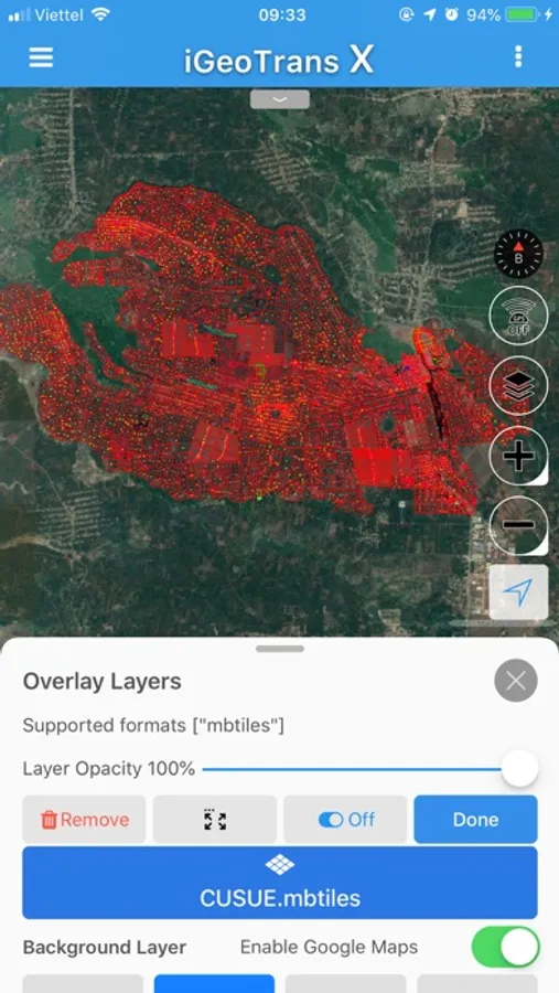
- Manage popular background map layers, allowing adding map overlays.
- Search by place, feature, and route.
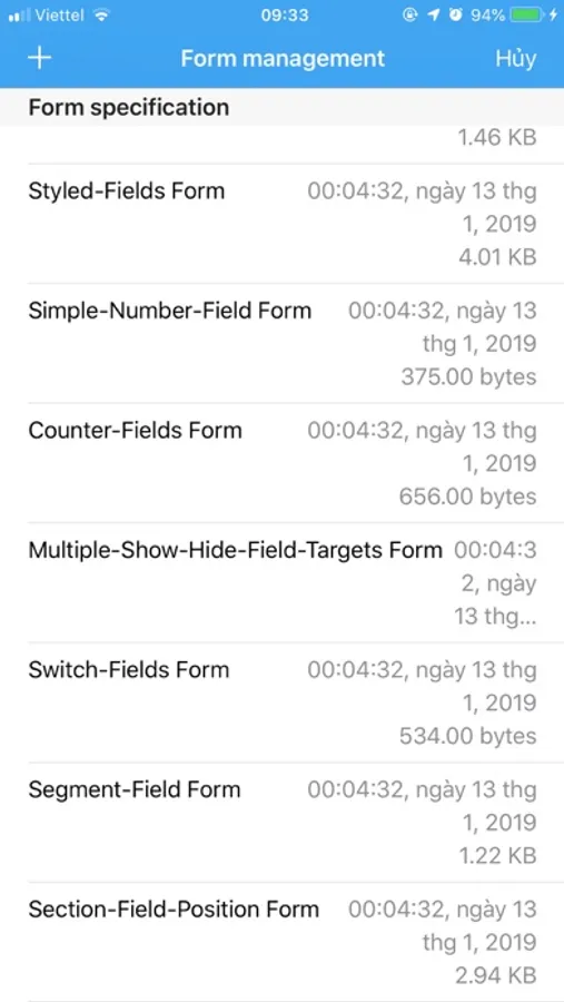
- Manage site survey and customs forms.
- Manage advanced settings.
__________________________________
We love hearing from our users, and we hope you will be our friend on the Internet.
Facebook: https://www.facebook.com/iGeoTrans/
Website: https://geomatics.vn
___________________
What can you do with iGeoTrans X:
- Record the route from a specific location to the site surveys and display on the map.
- Measure the distance between two specific locations by coordinates or selected on the map.
- Measure the area of a region according to the coordinates list or selected on the map.
- Take the photo with GPS coordinates.
- Create Markers, Polyline, Polygon using GPS positioning, or import from coordinates file.
- Create the geographic object (Features) using Point, LineString, and Polygon with custom forms to enter attribute data.
- Synchronize data between different devices via your iCloud account.
- Export data in popular formats to share with other software.
- Manage popular background map layers, allowing adding map overlays.
- Search by place, feature, and route.
- Manage site survey and customs forms.
- Manage advanced settings.
__________________________________
We love hearing from our users, and we hope you will be our friend on the Internet.
Facebook: https://www.facebook.com/iGeoTrans/
Website: https://geomatics.vn