About U-Level
U-Level 3D Terrain Mapping and Hardscape Leveling System
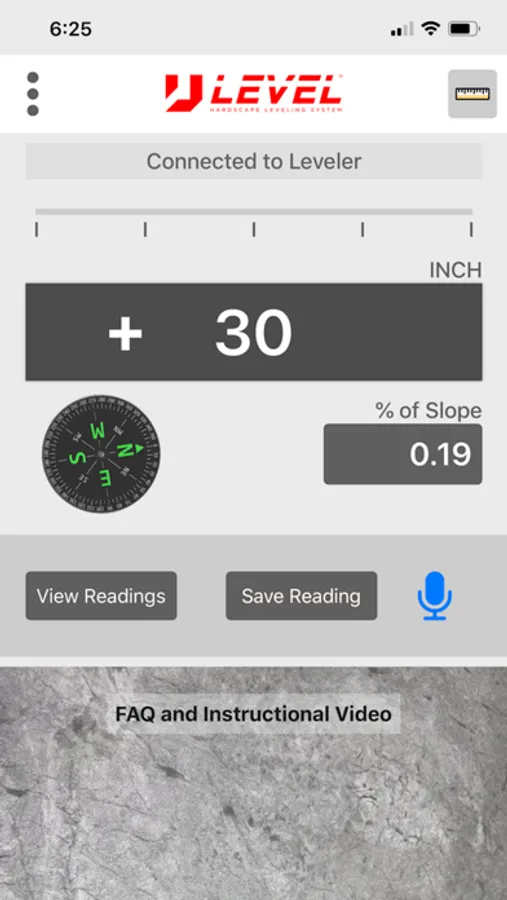
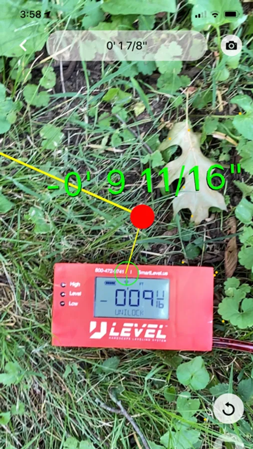
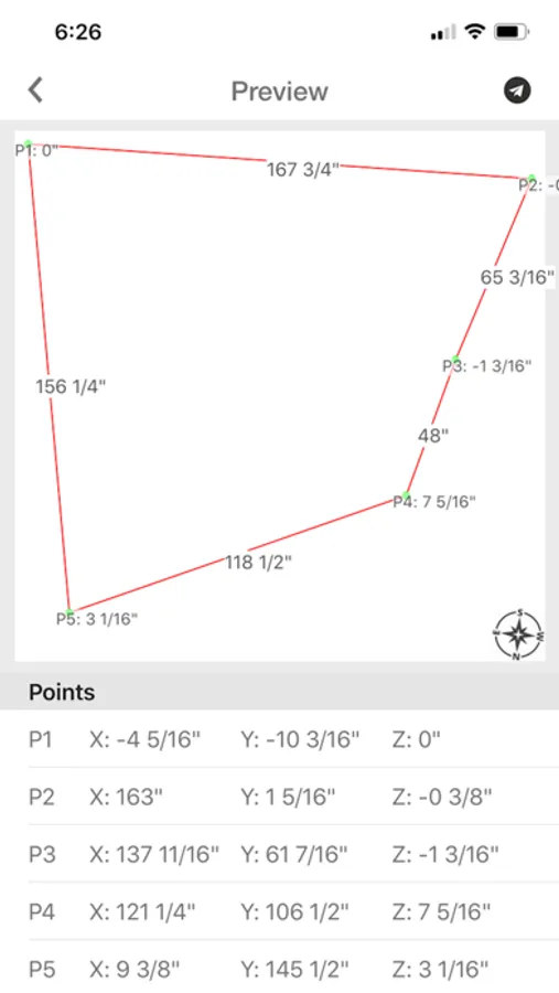
The only Precision Construction Altimeter on the market that allows you to plot or survey true 3D X,Y, and Z measurements then save, email, or upload directly into CAD. Seamlessly load your surveys into Uvision. The ultimate instrument for bidding jobs. Figures % of Slope, Engineering Scale- Feet above sea level, includes photos with data, and compass.
Designed for the true professional specifically for the Hardscape Industry by Hardscape Pros!