Touch GIS
TouchGIS
4.0 ★
store rating
Free
AppRecs review analysis
AppRecs rating 3.8. Trustworthiness 80 out of 100. Review manipulation risk 22 out of 100. Based on a review sample analyzed.
★★★☆☆
3.8
AppRecs Rating
Ratings breakdown
5 star
66%
4 star
3%
3 star
10%
2 star
10%
1 star
10%
What to know
✓
Low review manipulation risk
22% review manipulation risk
✓
Credible reviews
80% trustworthiness score from analyzed reviews
✓
Good user ratings
69% positive sampled reviews
About Touch GIS
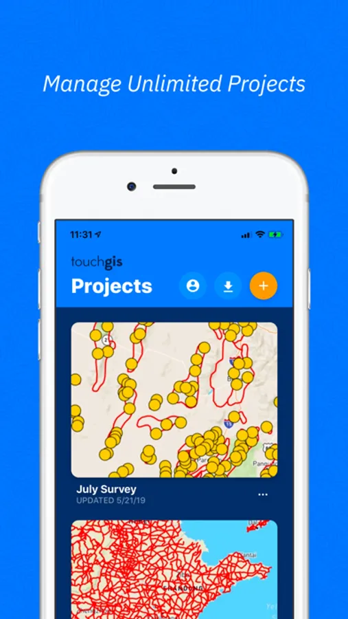
Touch GIS is the most intuitive professional field data collection and mapping tool available. It's a super-powered field notebook enabling you to collect any kind of data, in any environment, online or offline, and transfer it easily to your preferred desktop GIS. We believe your data collection tools should amplify your capabilities, not limit them, which is why we focus on keeping your forms and attributes totally customizable in the field.
Join thousands of professionals utilizing Touch GIS as their mobile GIS app to enhance their field work in geologic mapping, ecological mapping, civil engineering, mineral exploration and mining, natural resource management, landscape architecture, and more.
FEATURES
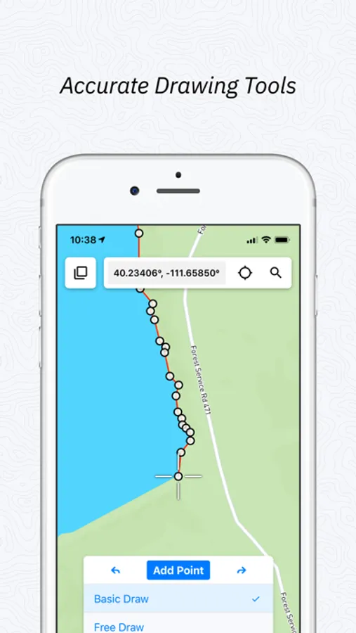
- Easily create new Points, Lines, Polygons, and Circles in the field.
- Quick and simple line and polygon drawing with free draw mode and vertex snapping.
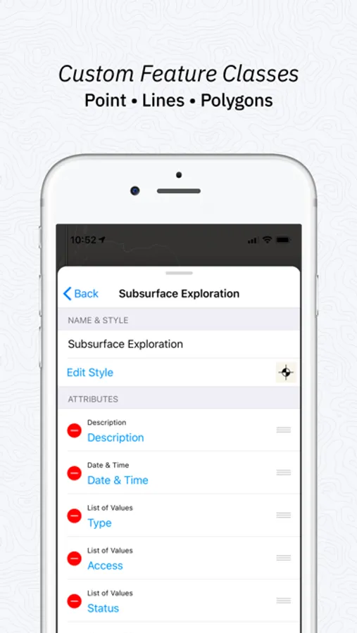
- Quickly adjust feature class collection and attribute forms in the field at any time
- Get multiple perspectives by switching between base maps in the field
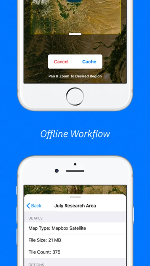
- Save map tiles for offline use
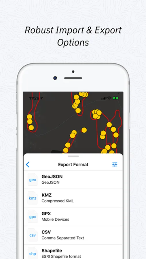
- Export to a variety of industry standard formats
- Snap, mark up, and attach photos to locations
- Measure planar and linear feature orientation using our clinometer tool with strike/dip, dip/dip direction, or trend/plunge formats.
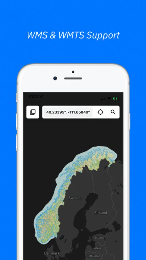
- Add custom base maps with WMS/WMTS
- Add Rasters and other overlays to your map
- Add team members so your whole team has access
FILE TYPES SUPPORTED
- Shapefile
- KML and KMZ
- GeoJSON
- GPX
- CSV
- World File
- Geotiff
- JPG
- PNG
- GeoPackage (GPKG)
Customizable attribute types:
- Description
- Date & Time
- Photos
- List Of Values
- Checkbox
- Address
- Number
- Website
- Phone Number
- Attitude / Orientation
- Make your own
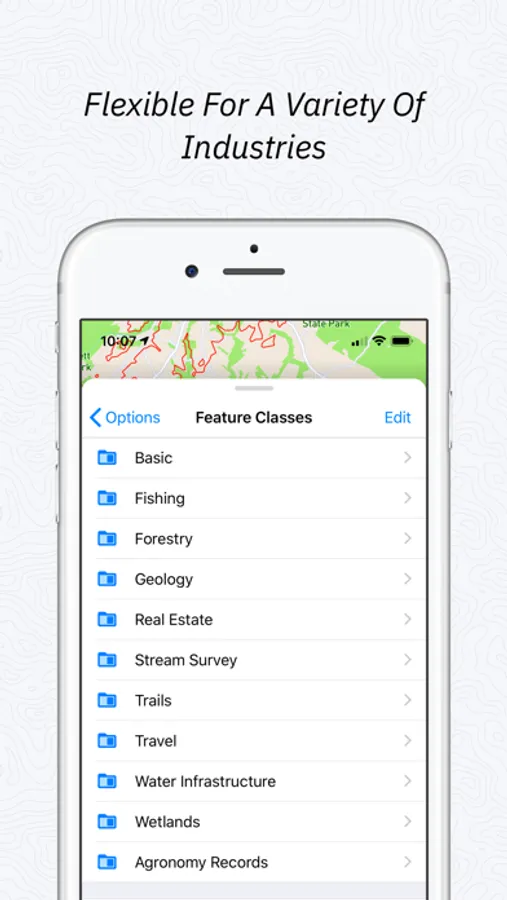
PRELOADED FEATURE CLASSES
- Forestry
- Geology
- Real Estate
- Stream Surveys
- Water Infrastructure
- Wetlands
- Create Your Own!
Terms of Service: https://www.touchgis.app/terms-of-service
Privacy Policy: https://www.touchgis.app/privacy
Join thousands of professionals utilizing Touch GIS as their mobile GIS app to enhance their field work in geologic mapping, ecological mapping, civil engineering, mineral exploration and mining, natural resource management, landscape architecture, and more.
FEATURES
- Easily create new Points, Lines, Polygons, and Circles in the field.
- Quick and simple line and polygon drawing with free draw mode and vertex snapping.
- Quickly adjust feature class collection and attribute forms in the field at any time
- Get multiple perspectives by switching between base maps in the field
- Save map tiles for offline use
- Export to a variety of industry standard formats
- Snap, mark up, and attach photos to locations
- Measure planar and linear feature orientation using our clinometer tool with strike/dip, dip/dip direction, or trend/plunge formats.
- Add custom base maps with WMS/WMTS
- Add Rasters and other overlays to your map
- Add team members so your whole team has access
FILE TYPES SUPPORTED
- Shapefile
- KML and KMZ
- GeoJSON
- GPX
- CSV
- World File
- Geotiff
- JPG
- PNG
- GeoPackage (GPKG)
Customizable attribute types:
- Description
- Date & Time
- Photos
- List Of Values
- Checkbox
- Address
- Number
- Website
- Phone Number
- Attitude / Orientation
- Make your own
PRELOADED FEATURE CLASSES
- Forestry
- Geology
- Real Estate
- Stream Surveys
- Water Infrastructure
- Wetlands
- Create Your Own!
Terms of Service: https://www.touchgis.app/terms-of-service
Privacy Policy: https://www.touchgis.app/privacy