AppRecs review analysis
AppRecs rating 4.4. Trustworthiness 64 out of 100. Review manipulation risk 25 out of 100. Based on a review sample analyzed.
★★★★☆
4.4
AppRecs Rating
Ratings breakdown
5 star
92%
4 star
8%
3 star
0%
2 star
0%
1 star
0%
What to know
✓
Low review manipulation risk
25% review manipulation risk
✓
High user satisfaction
92% of sampled ratings are 5 stars
About The MST Guide
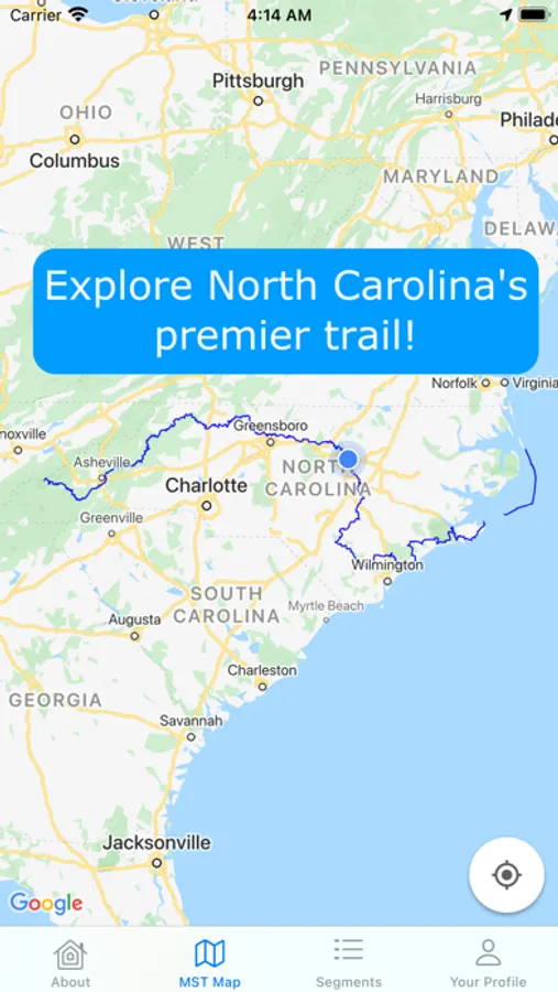
The North Carolina Mountains-to-Sea Trail (MST) is nearly 1200 miles long, connecting Clingman’s Dome in the Great Smoky Mountains to Jockey’s Ridge in the Outer Banks. This is the most comprehensive guide ever developed for the MST, providing unprecedented information and ease of access for day-, section-, and thru-hikers.
NEVER GET LOST
See your location in relation to the trail and know which way to go, even when there are no blazes. Know how far away you are from key waypoints.
UP-TO-DATE MAPS
Thanks to the many volunteers, the MST is developing more every year and is constantly being rerouted. This app is updated with every change, so there is no need to keep track of trail updates. Hikers can view their location in relation to the entire MST, or just see the segment they are currently on.
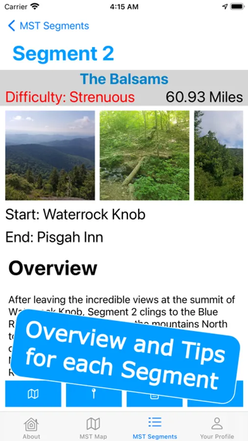
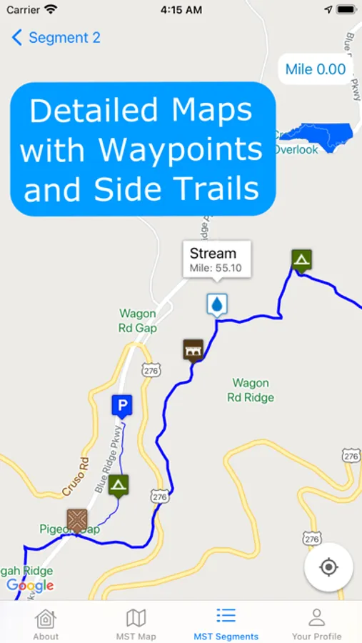
UNLOCK ACCURATE, USEFUL WAYPOINTS
Everything you need from parking locations for your day hike to camping locations for your thru-hike. Locate water sources that are unlisted in other guides, discover hidden gems that you hadn't known about before, or simply determine your own location. Each waypoint has it's exact location, distance along the trail, and a detailed description (when applicable).
VIRTUAL TRAIL LOGS
Communicate with other hikers through comments on each trail segment or waypoint. Leave behind useful information, ask questions, or leave reviews. Learn from those who have come before you, or use comments to help plan your route.
More features coming soon!
NEVER GET LOST
See your location in relation to the trail and know which way to go, even when there are no blazes. Know how far away you are from key waypoints.
UP-TO-DATE MAPS
Thanks to the many volunteers, the MST is developing more every year and is constantly being rerouted. This app is updated with every change, so there is no need to keep track of trail updates. Hikers can view their location in relation to the entire MST, or just see the segment they are currently on.
UNLOCK ACCURATE, USEFUL WAYPOINTS
Everything you need from parking locations for your day hike to camping locations for your thru-hike. Locate water sources that are unlisted in other guides, discover hidden gems that you hadn't known about before, or simply determine your own location. Each waypoint has it's exact location, distance along the trail, and a detailed description (when applicable).
VIRTUAL TRAIL LOGS
Communicate with other hikers through comments on each trail segment or waypoint. Leave behind useful information, ask questions, or leave reviews. Learn from those who have come before you, or use comments to help plan your route.
More features coming soon!