AppRecs review analysis
AppRecs rating 4.3. Trustworthiness 67 out of 100. Review manipulation risk 27 out of 100. Based on a review sample analyzed.
★★★★☆
4.3
AppRecs Rating
Ratings breakdown
5 star
95%
4 star
0%
3 star
0%
2 star
0%
1 star
5%
What to know
✓
Low review manipulation risk
27% review manipulation risk
✓
High user satisfaction
95% of sampled ratings are 5 stars
About NexusLRS
NexusLRS is an app that allows users of a road network to view their location on a road network (LRS) as a local municipalities see it. (typically state DOTs) Features include:
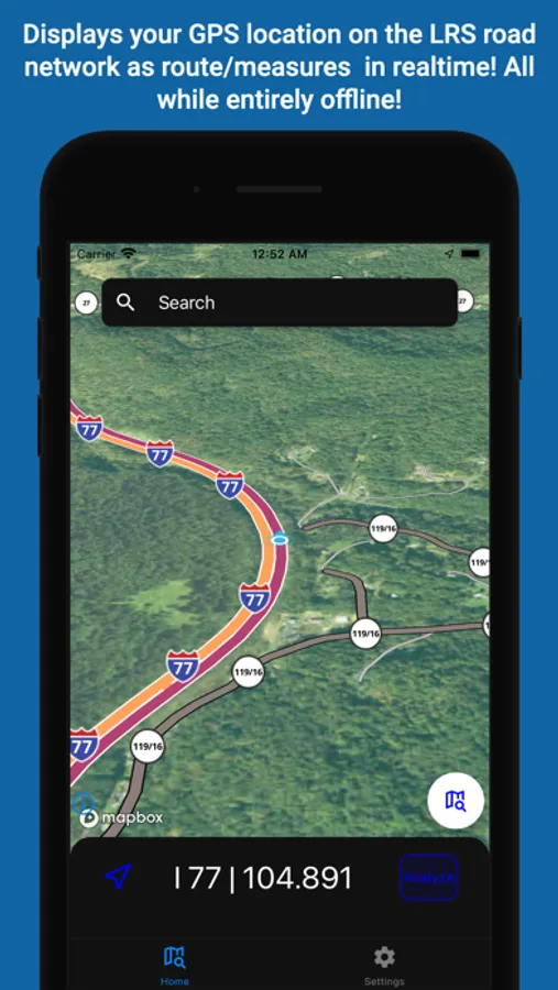
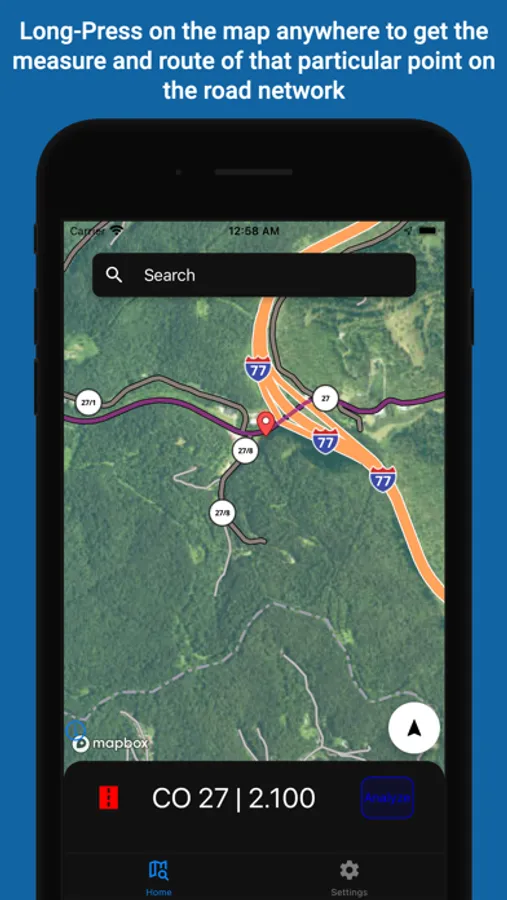
* Shows your position on the LRS (milepoint/routeid) updated in real time at a frequency of once every second
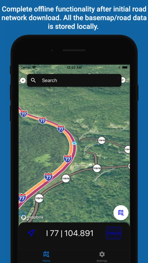
* Works entirely offline after initially download no network capabilities needed (a user is associated with single municipality)
* Offline mapping to view your road network from a base map downloaded locally on the phone
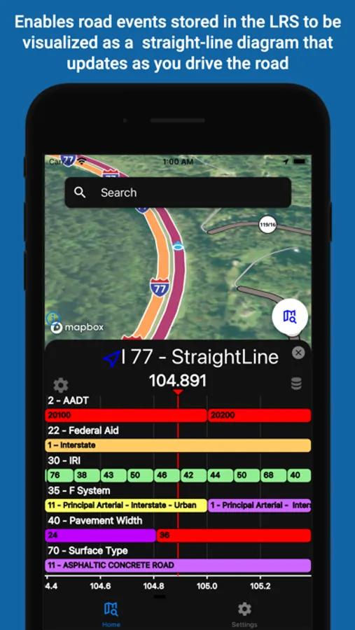
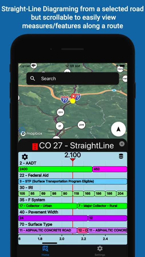
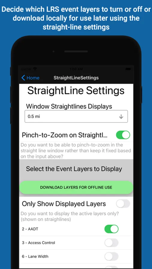
* Displays straight line diagrams of linear features along a route
NexusLRS is designed to be a platform that allows anyone who might need to see a road network as state DOT might see it. Typical users would be people/organizations that deal with DOTs a lot or DOT workers themselves. Access to such data in the field or at all is pretty sparse, this app changes that.
* Shows your position on the LRS (milepoint/routeid) updated in real time at a frequency of once every second
* Works entirely offline after initially download no network capabilities needed (a user is associated with single municipality)
* Offline mapping to view your road network from a base map downloaded locally on the phone
* Displays straight line diagrams of linear features along a route
NexusLRS is designed to be a platform that allows anyone who might need to see a road network as state DOT might see it. Typical users would be people/organizations that deal with DOTs a lot or DOT workers themselves. Access to such data in the field or at all is pretty sparse, this app changes that.