VatView
Oren Geva
3.6 ★
store rating
Free
AppRecs review analysis
AppRecs rating 3.4. Trustworthiness 83 out of 100. Review manipulation risk 25 out of 100. Based on a review sample analyzed.
★★★☆☆
3.4
AppRecs Rating
Ratings breakdown
5 star
43%
4 star
0%
3 star
43%
2 star
0%
1 star
14%
What to know
✓
Low review manipulation risk
25% review manipulation risk
✓
Credible reviews
83% trustworthiness score from analyzed reviews
About VatView
VatView is a mobile app that allows flight simulation enthusiasts to track ATC presence and flight information on the VATSIM network.
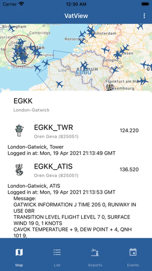
VatView aims to be your ultimate VATSIM companion! It provides easy access to active VATSIM terminal area ATC stations and frequencies and exposes the ATIS message easily. It also shows enroute ATC, including marking land, oceanic, UIR and FSS VATSIM controlled areas on the map.
VatView features three main views:
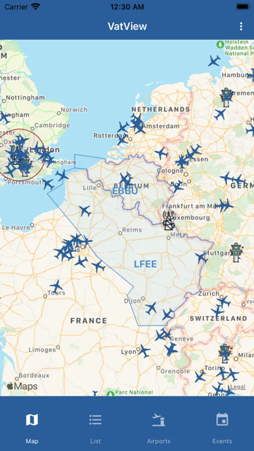
- a map displaying all pilots and air traffic controllers currently connected to the VATSIM network.
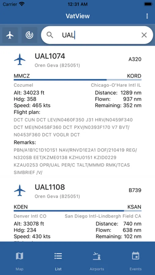
- A filterable and searchable list page - displaying a detailed list of all connected pilots and ATC.
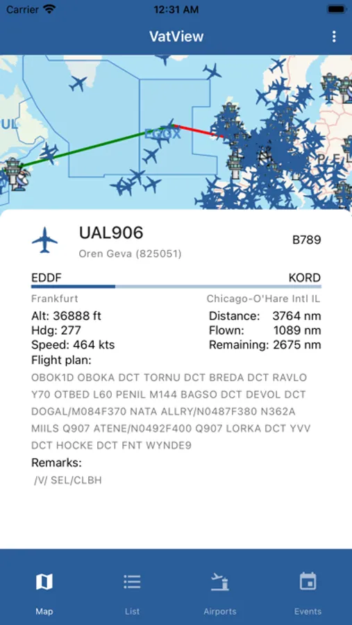
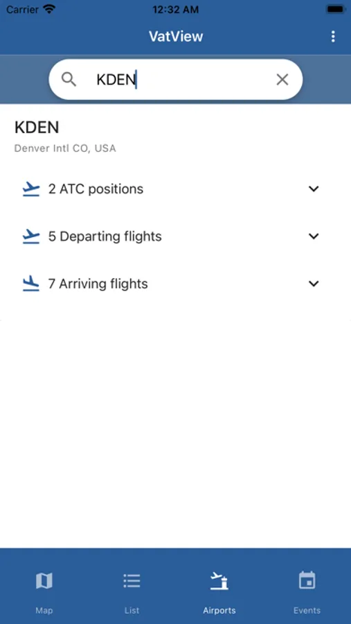
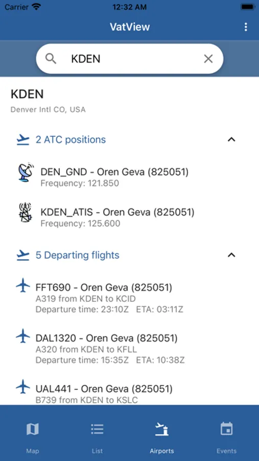
- An airport search page - which concentrates all connected ATC, active flights and prefiled flight plans for a specific airport.
VATSIM (short for the Virtual Air Traffic Simulation Network) is a completely free online platform that allows Flight simulator enthusiasts connect and fly virtually on one shared virtual aviation eco system. It simulates Air Traffic Control (ATC) with full voice and network connection between virtual pilots flight on flight simulator software and virtual air traffic controllers using software for providing ATC services. It is as real as it gets.
It supports Microsoft's Flight simulator (MSFS, FSX and FS9), P3D and X-Plane.
For more information visit https://www.vatsim.net.
Features:
- An Interactive map displaying VATSIM pilots and ATC
- Detailed aircraft and terminal ATC station Icons
- Enroute and FSS control areas
- Live METAR (weather) data for any airport
- ATC Bookings
- Always up to date FIR boundaries synced with VATSpy's data project
- Detailed flight information
- Filterable and searchable list screen
- An easy way to get all relevant terminal area stations with the relevant ATIS message
* The app uses the storage permission to cache large airspace data it needs to display on the map.
Disclaimer:
The author is not affiliated with the VATSIM Organization in any way (other than being an enthusiastic user and member of the community)
VatView aims to be your ultimate VATSIM companion! It provides easy access to active VATSIM terminal area ATC stations and frequencies and exposes the ATIS message easily. It also shows enroute ATC, including marking land, oceanic, UIR and FSS VATSIM controlled areas on the map.
VatView features three main views:
- a map displaying all pilots and air traffic controllers currently connected to the VATSIM network.
- A filterable and searchable list page - displaying a detailed list of all connected pilots and ATC.
- An airport search page - which concentrates all connected ATC, active flights and prefiled flight plans for a specific airport.
VATSIM (short for the Virtual Air Traffic Simulation Network) is a completely free online platform that allows Flight simulator enthusiasts connect and fly virtually on one shared virtual aviation eco system. It simulates Air Traffic Control (ATC) with full voice and network connection between virtual pilots flight on flight simulator software and virtual air traffic controllers using software for providing ATC services. It is as real as it gets.
It supports Microsoft's Flight simulator (MSFS, FSX and FS9), P3D and X-Plane.
For more information visit https://www.vatsim.net.
Features:
- An Interactive map displaying VATSIM pilots and ATC
- Detailed aircraft and terminal ATC station Icons
- Enroute and FSS control areas
- Live METAR (weather) data for any airport
- ATC Bookings
- Always up to date FIR boundaries synced with VATSpy's data project
- Detailed flight information
- Filterable and searchable list screen
- An easy way to get all relevant terminal area stations with the relevant ATIS message
* The app uses the storage permission to cache large airspace data it needs to display on the map.
Disclaimer:
The author is not affiliated with the VATSIM Organization in any way (other than being an enthusiastic user and member of the community)