York County Incidents & Radio
Lancaster Decisions, LLC
2.4 ★
store rating
Free
AppRecs review analysis
AppRecs rating 2.3. Trustworthiness 74 out of 100. Review manipulation risk 21 out of 100. Based on a review sample analyzed.
★★☆☆☆
2.3
AppRecs Rating
Ratings breakdown
5 star
14%
4 star
23%
3 star
0%
2 star
14%
1 star
50%
What to know
✓
Low review manipulation risk
21% review manipulation risk
✓
Credible reviews
74% trustworthiness score from analyzed reviews
⚠
Mixed user feedback
Average 2.4★ rating suggests room for improvement
About York County Incidents & Radio
Mobile access to the York County public WebCad information. Includes other areas as well so you can follow events in surrounding counties as well.
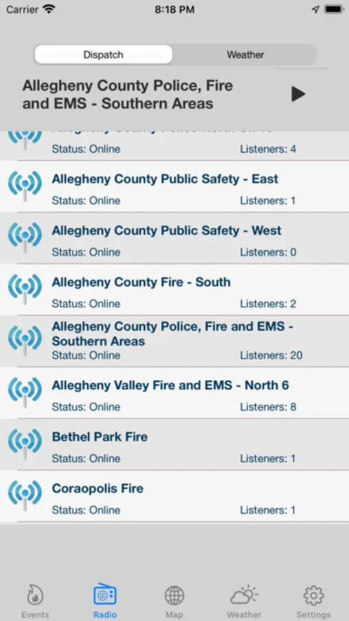
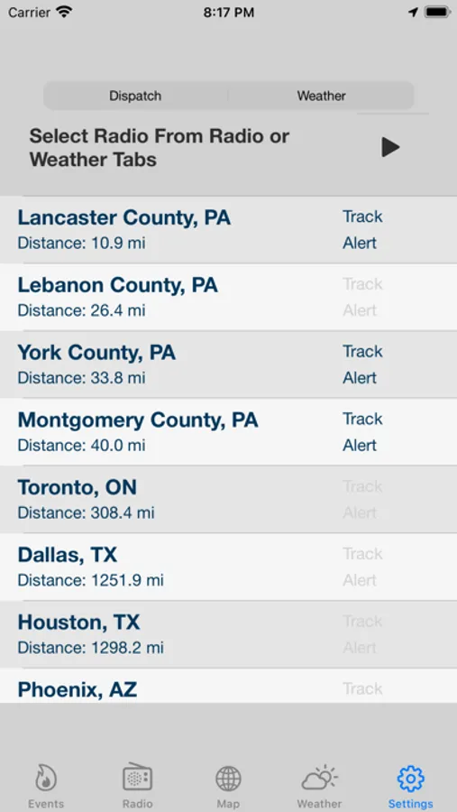
Multiple radio feeds let you listen to all emergency responders in York and surrounding counties including Northern Maryland and Baltimore. Feeds include Police, Fire, and EMS through both county dispatch and fireground operations.
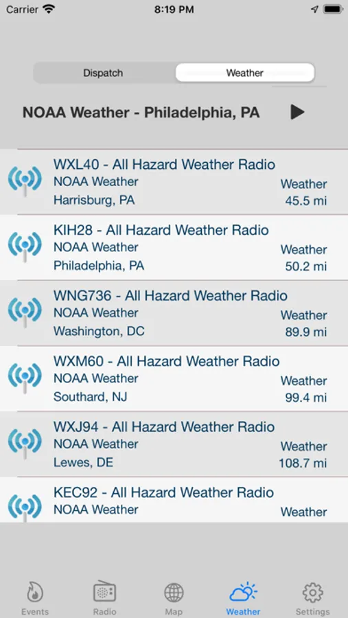
Includes NOAA All Hazard Weather Radio so you can listen to up to the minute weather forecasts for across the country.
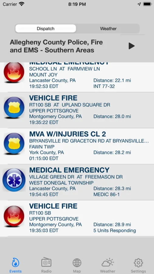
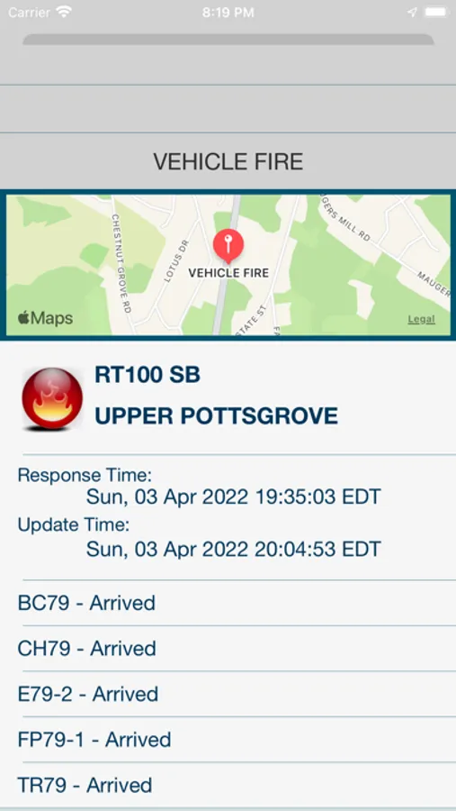
York County Emergency Radio geolocates live emergency incident responses for York County, Pennsylvania. Find the location and description of current fire, EMS, and traffic incidents. Live radio stream lets you listen to the events as they unfold. While listening, York Co Radio shows you where the incident is, describes what is happening, and provides the details of who is involved.
York Co Radio also provides invaluable information while travelling. By knowing the location of potential traffic problems, you can plan your route to avoid the possible delays.
Features include:
- Access to multiple live radio streams for Police, Fire, and EMS in York County, PA
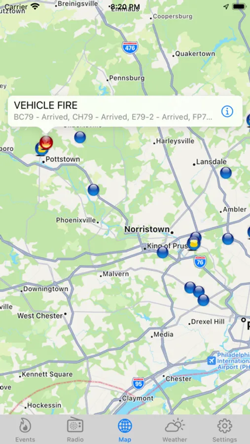
- Map showing current location of all fire, traffic, and other emergency incidents
- Popup window showing type of incident and responding units
- List view of all current emergency incidents with a list of first responders, their location and the response time
- Information is automatically refreshed every two minutes so that you can follow the information as it changes and know when the emergency has cleared.
- Map Icons clearly indicate the type of incident.
- Detail window describing the nature of the incident, time that it occurred in the local time for the device, location, and easily viewed list of responding units.
- Zoom from detail screen to individual incident location on map.
Multiple radio feeds let you listen to all emergency responders in York and surrounding counties including Northern Maryland and Baltimore. Feeds include Police, Fire, and EMS through both county dispatch and fireground operations.
Includes NOAA All Hazard Weather Radio so you can listen to up to the minute weather forecasts for across the country.
York County Emergency Radio geolocates live emergency incident responses for York County, Pennsylvania. Find the location and description of current fire, EMS, and traffic incidents. Live radio stream lets you listen to the events as they unfold. While listening, York Co Radio shows you where the incident is, describes what is happening, and provides the details of who is involved.
York Co Radio also provides invaluable information while travelling. By knowing the location of potential traffic problems, you can plan your route to avoid the possible delays.
Features include:
- Access to multiple live radio streams for Police, Fire, and EMS in York County, PA
- Map showing current location of all fire, traffic, and other emergency incidents
- Popup window showing type of incident and responding units
- List view of all current emergency incidents with a list of first responders, their location and the response time
- Information is automatically refreshed every two minutes so that you can follow the information as it changes and know when the emergency has cleared.
- Map Icons clearly indicate the type of incident.
- Detail window describing the nature of the incident, time that it occurred in the local time for the device, location, and easily viewed list of responding units.
- Zoom from detail screen to individual incident location on map.