In this weather app, you can view real-time avalanche danger levels and detailed forecasts for multiple regions. Includes color-coded maps, regional selection, and forecast updates from over 20 centers.
AppRecs review analysis
AppRecs rating 4.5. Trustworthiness 73 out of 100. Review manipulation risk 27 out of 100. Based on a review sample analyzed.
★★★★☆
4.5
AppRecs Rating
Ratings breakdown
5 star
82%
4 star
11%
3 star
2%
2 star
1%
1 star
3%
What to know
✓
Low review manipulation risk
27% review manipulation risk
✓
Credible reviews
73% trustworthiness score from analyzed reviews
✓
High user satisfaction
82% of sampled ratings are 5 stars
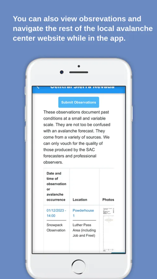
About Avalanche Forecasts
Get real-time updates on avalanche danger levels with Avalanche Forecasts.
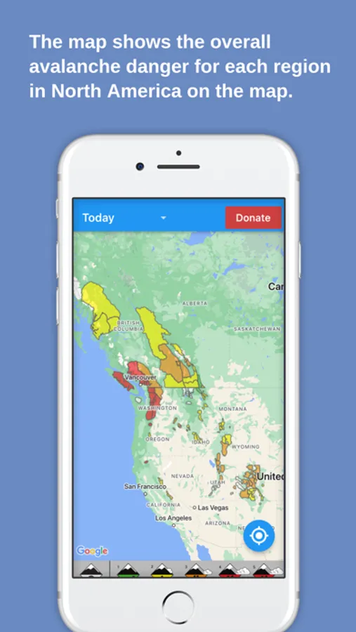
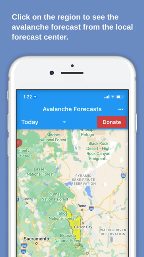
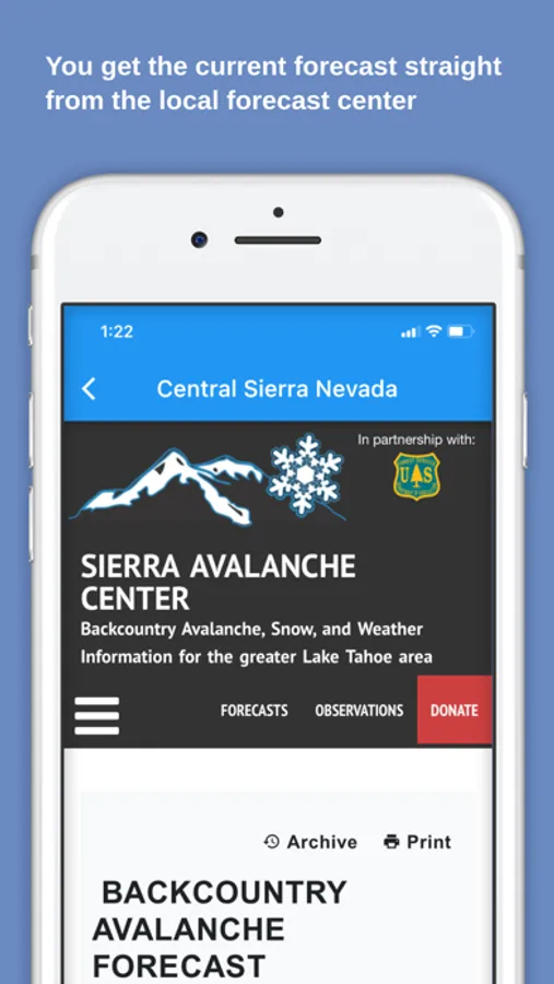
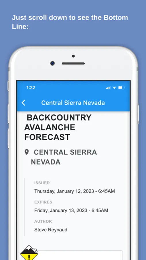
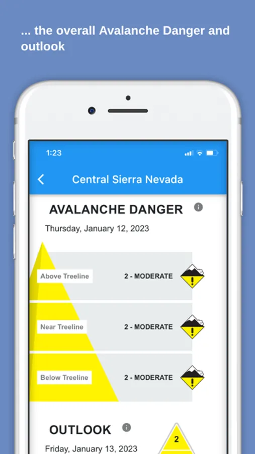
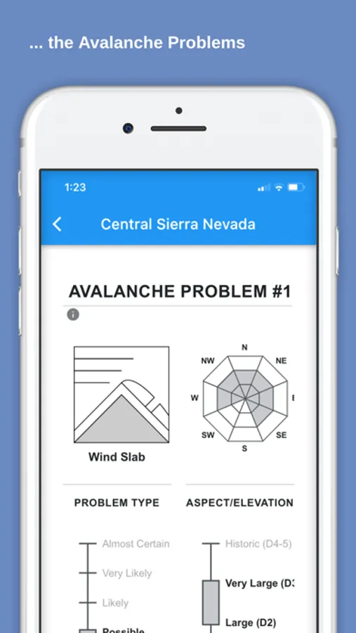
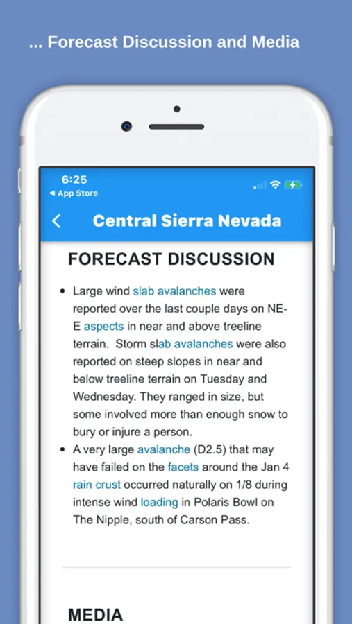
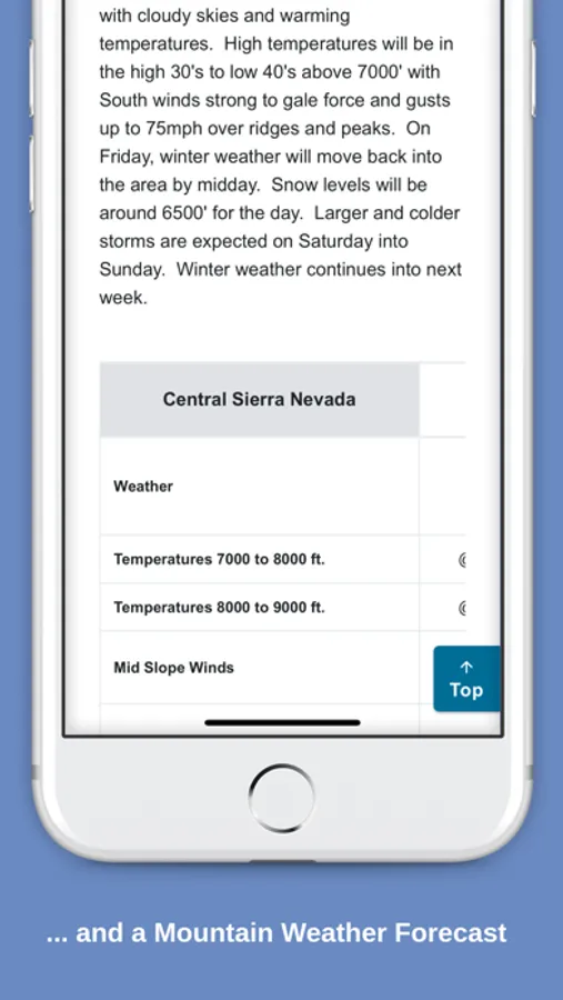
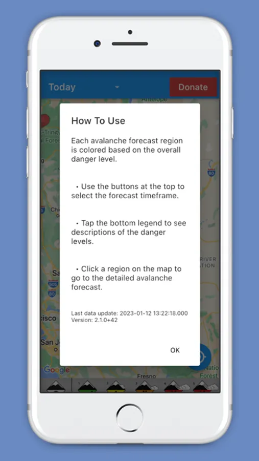
Our app makes it easy to see current danger levels at-a-glance for every forecast center in North America. Simply select your desired timeframe (Today/Tomorrow/2 Days Out) and view color-coded danger levels on the map. Click on any region to view the detailed avalanche forecast from the source forecasting center.
With support for forecasts from over 20 centers, including NWAC (Northwest US), CAIC (Colorado), UAC (Utah), SAC (Central Sierras), ESAC (Eastern Sierras), MSAC (Mount Shasta), BAC (Bridgeport, CA), BTAC (Jackson Hole), GNFAC (Bozeman), WCMAC (Missoula), FAC (Kalispell/Whitefish), SNFAC (Sun Valley), IPAC (Idaho Panhandle), PAC (McCall), MWAC (Mount Washington), KPAC (Flagstaff), TAC (Taos), WAC (NE Oregon), CNFAIC (Chugach), JAC (Juneau), AAC (Anchorage), HAIC (Haines), VAC (Valdez), Cordova, HPAC (Hatcher Pass), Avalanche Canada, Parks Canada, WhistlerBlackcomb, VIAC (Vancouver Island), and Avalanche Quebec (Chic Chocs) forecasting centers, you can stay informed no matter where you are.
For feature suggestions, bug reports, or other feedback, please contact us at project-development@sierraavalanchecenter.org.