With this multitool app, you can access location information, including coordinates, altitude, and speed, as well as use emergency features like an earthquake alarm and flashlight. Includes a compass, overlay map, altitude and speed measurements, and location sharing options.
AppRecs review analysis
AppRecs rating 3.4. Trustworthiness 73 out of 100. Review manipulation risk 23 out of 100. Based on a review sample analyzed.
★★★☆☆
3.4
AppRecs Rating
Ratings breakdown
5 star
67%
4 star
6%
3 star
3%
2 star
2%
1 star
22%
What to know
✓
Low review manipulation risk
23% review manipulation risk
✓
Credible reviews
73% trustworthiness score from analyzed reviews
⚠
Ad complaints
Many low ratings mention excessive ads
About iTools - Pocket Multi Tool
"WHAT IS IT :: A Navigation & Emergency Multitool Always in Pocket
WHO IT’S FOR :: Everyone in move, by Car, Airplane or Boat
WHY IS USEFUL ::
- It gives you important location information,
- Can alarm and save crucial seconds when an earthquake occurs - especially during sleeping,
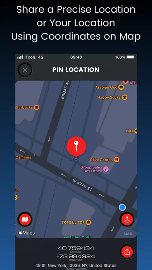
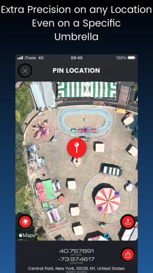
- Can share an exact location everywhere by using coordinates
HOW IT WORKS?
__GUIDANCE__
It shows you all the necessary information all in one place and one screen.
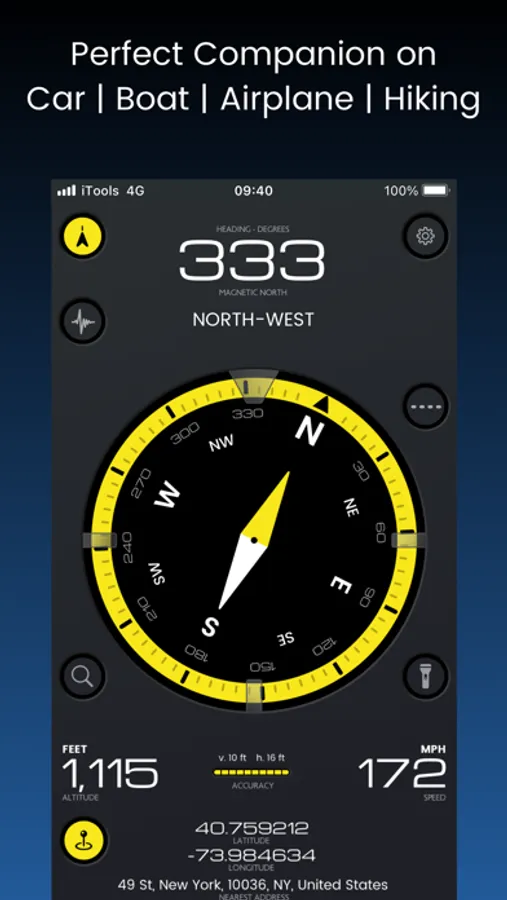
• Compass with Heading and Degrees
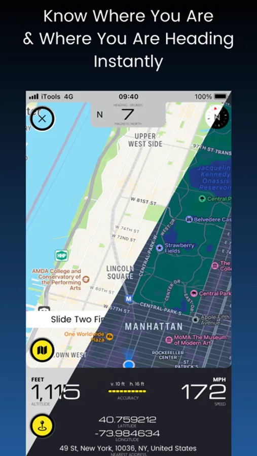
• Overlay Map with Heading View & 3D
• Altitude
• Speed
• Full Location Info (Address, Coordinates)
Units Supported:
• Altitude: Feet, Miles, Nautical Miles, Meters, Kilometers
• Speed: Knots, Miles per Hour, Kilometers per Hour, Meters per Second
In addition, this app gives you flashlight tools, designed for finding things at emergency situations.
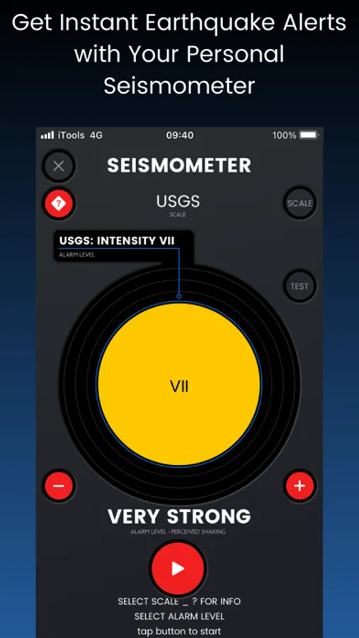
__SEISMOMETER__
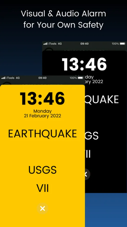
It can alarm you at night and can save you important seconds to act as planned on an earthquake.
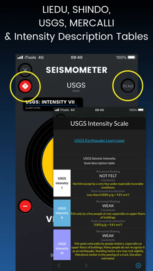
It senses and translates movements into the four most used earthquake intensity scales in the world:
• Shindo (Japan)
• USGS (USA)
• Liedu (China)
• Mercalli (World)
*seismos is the greek word “σεισμός” that means earthquake
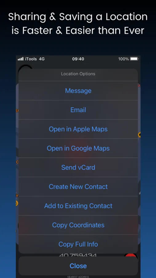
__LOCATION SHARING__
You can also send your current location or any other point in the map.
You have the following options:
• send a precise location through email or a message (iMessage, SMS),
• save it as a new contact
• save it in an existing contact,
• open it in both Apple & Google maps,
• copy the coordinates link to paste it anywhere you like.
_________________
In case you need this app in your language, please contact support!
* Internet connectivity (3G or WiFi) required for some functions"
WHO IT’S FOR :: Everyone in move, by Car, Airplane or Boat
WHY IS USEFUL ::
- It gives you important location information,
- Can alarm and save crucial seconds when an earthquake occurs - especially during sleeping,
- Can share an exact location everywhere by using coordinates
HOW IT WORKS?
__GUIDANCE__
It shows you all the necessary information all in one place and one screen.
• Compass with Heading and Degrees
• Overlay Map with Heading View & 3D
• Altitude
• Speed
• Full Location Info (Address, Coordinates)
Units Supported:
• Altitude: Feet, Miles, Nautical Miles, Meters, Kilometers
• Speed: Knots, Miles per Hour, Kilometers per Hour, Meters per Second
In addition, this app gives you flashlight tools, designed for finding things at emergency situations.
__SEISMOMETER__
It can alarm you at night and can save you important seconds to act as planned on an earthquake.
It senses and translates movements into the four most used earthquake intensity scales in the world:
• Shindo (Japan)
• USGS (USA)
• Liedu (China)
• Mercalli (World)
*seismos is the greek word “σεισμός” that means earthquake
__LOCATION SHARING__
You can also send your current location or any other point in the map.
You have the following options:
• send a precise location through email or a message (iMessage, SMS),
• save it as a new contact
• save it in an existing contact,
• open it in both Apple & Google maps,
• copy the coordinates link to paste it anywhere you like.
_________________
In case you need this app in your language, please contact support!
* Internet connectivity (3G or WiFi) required for some functions"