In this earthquake monitoring app, users can view recent seismic activity through maps and timelines and set push notifications for specific events. Includes map layers, location filters, data export options, and social sharing features.
AppRecs review analysis
AppRecs rating 4.8. Trustworthiness 69 out of 100. Review manipulation risk 20 out of 100. Based on a review sample analyzed.
★★★★☆
4.8
AppRecs Rating
Ratings breakdown
5 star
85%
4 star
10%
3 star
3%
2 star
0%
1 star
2%
What to know
✓
Low review manipulation risk
20% review manipulation risk
✓
High user satisfaction
85% of sampled ratings are 5 stars
✓
Authentic reviews
No red flags detected
About Terremoto
Terremoto shows the latest earthquake data for the Italian peninsula, as reported by INGV (National Institute of Geophysics and Volcanology). Includes free push notification alerts. Supports Apple Watch. Main features:
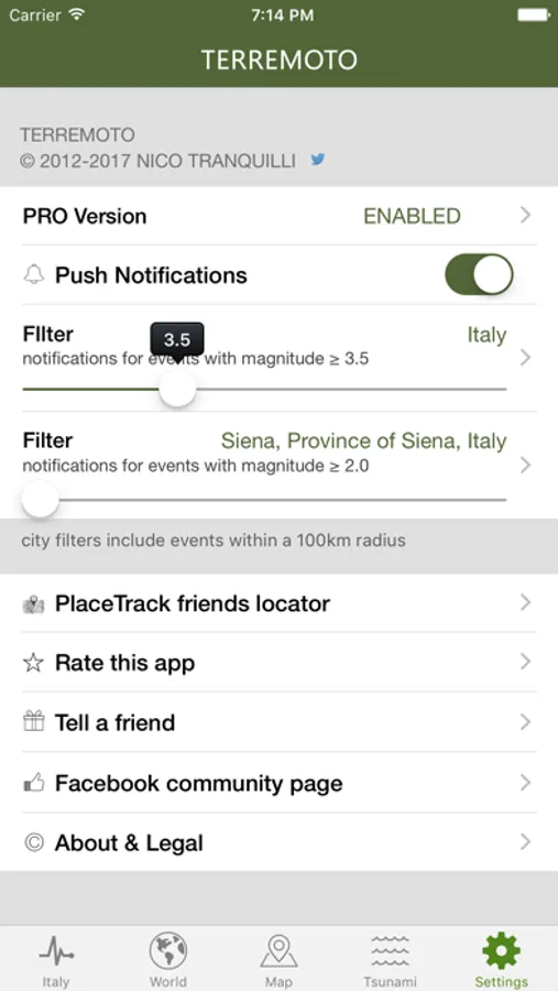
• push notifications on your phone as soon as the event data is available from an official source (you can set alerts based on location and/or magnitude threshold)
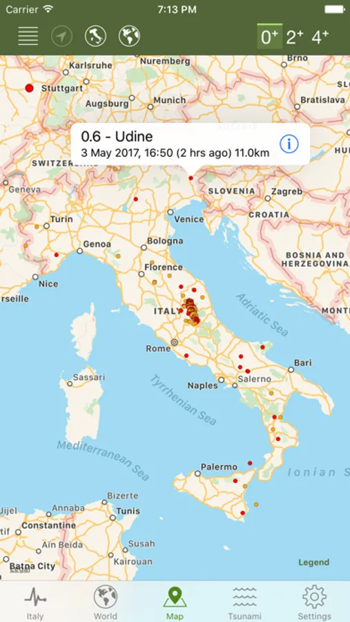
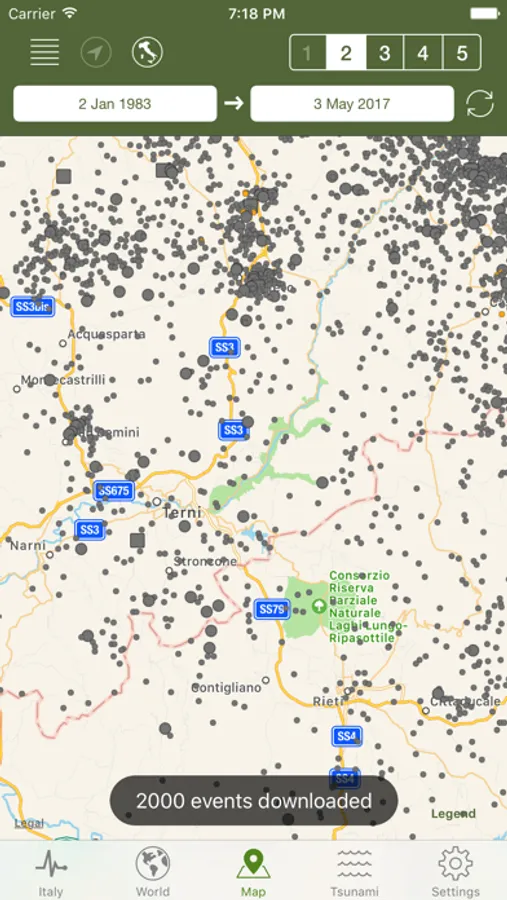
• map with different sized and colored circles to represent event magnitude and age
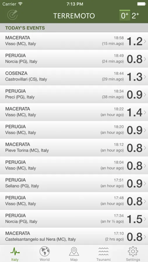
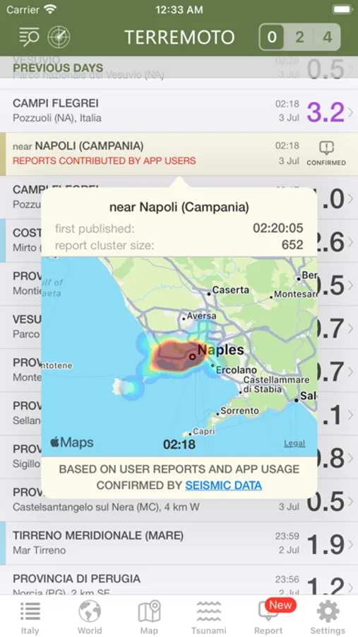
• event timeline (today, yesterday, previous days)
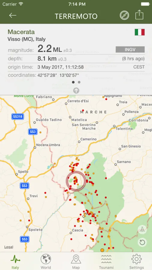
• detail view for each event, reachable from map and timeline views
• magnitude and local (same country) event filters
• export data to Google Earth or other installed apps supporting kml file format
• share seismic events on social networks
• reverse geocoding: names of locations, when unavailable, are calculated automatically from their geographical coordinates
• widgets for your home screen or today view, to keep the latest seismic data at your fingertips
• support for Dark Mode and Critical Alerts
• map layers: tectonic plate boundaries, orogens, volcanoes, nuclear power plants, population density
• population and built-up surface estimates for each seismic event
• extra feature: worldwide events from multiple sources, available as in-app-purchase
• NOAA tsunami bulletins (PRO version only)
• search earthquake events by date, city, country, continent and reporting agency
• Siri Shortcuts support - "Hey Siri, what are the latest earthquakes in Italy?"
• multiple languages: the app is localized in English, Spanish, French, German, Italian
• following a potential seismic event, the app analyzes user reports and app usage data to provide an estimated location within 60-120 seconds, pending official confirmation.
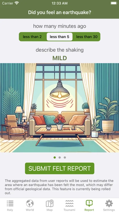
• option to report a recently felt seismic event
Data source: © ISIDe Working Group (INGV, 2010), Italian Seismological Instrumental and parametric database.
This is an independent app and is not affiliated with or endorsed by INGV.
• push notifications on your phone as soon as the event data is available from an official source (you can set alerts based on location and/or magnitude threshold)
• map with different sized and colored circles to represent event magnitude and age
• event timeline (today, yesterday, previous days)
• detail view for each event, reachable from map and timeline views
• magnitude and local (same country) event filters
• export data to Google Earth or other installed apps supporting kml file format
• share seismic events on social networks
• reverse geocoding: names of locations, when unavailable, are calculated automatically from their geographical coordinates
• widgets for your home screen or today view, to keep the latest seismic data at your fingertips
• support for Dark Mode and Critical Alerts
• map layers: tectonic plate boundaries, orogens, volcanoes, nuclear power plants, population density
• population and built-up surface estimates for each seismic event
• extra feature: worldwide events from multiple sources, available as in-app-purchase
• NOAA tsunami bulletins (PRO version only)
• search earthquake events by date, city, country, continent and reporting agency
• Siri Shortcuts support - "Hey Siri, what are the latest earthquakes in Italy?"
• multiple languages: the app is localized in English, Spanish, French, German, Italian
• following a potential seismic event, the app analyzes user reports and app usage data to provide an estimated location within 60-120 seconds, pending official confirmation.
• option to report a recently felt seismic event
Data source: © ISIDe Working Group (INGV, 2010), Italian Seismological Instrumental and parametric database.
This is an independent app and is not affiliated with or endorsed by INGV.