About BatNav
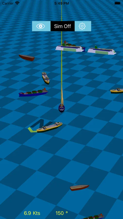
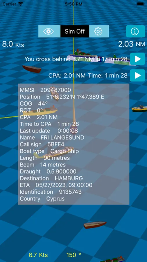
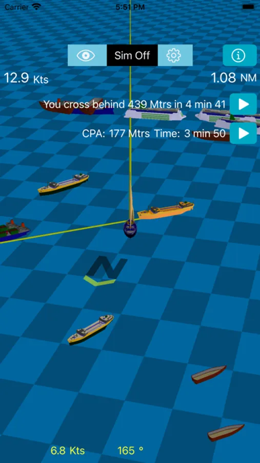
BatNav uses your existing AIS and GPS instruments to show your position and that of other boats in your vicinity in a 3D graphics view. It estimates how close you get to other boats and determines whether you pass in front or behind. It is extremely useful in scenarios with lots of ships crossing your path where it can be difficult to determine in advance where you will pass a ship.
Tested in the English Channel, the world's busiest shipping route.
In simulation mode, it can show you where you will be in the future relative to other boats. In this mode, you can also test scenarios such as changing your speed or direction.
It works in conjunction with devices that put your instrument information on the WiFi network such as those provided by Digital Yacht and Quark. A separate Raspberry Pi project also allows you to build your own WiFi device in a relatively straightforward manner.