About fireDNPX
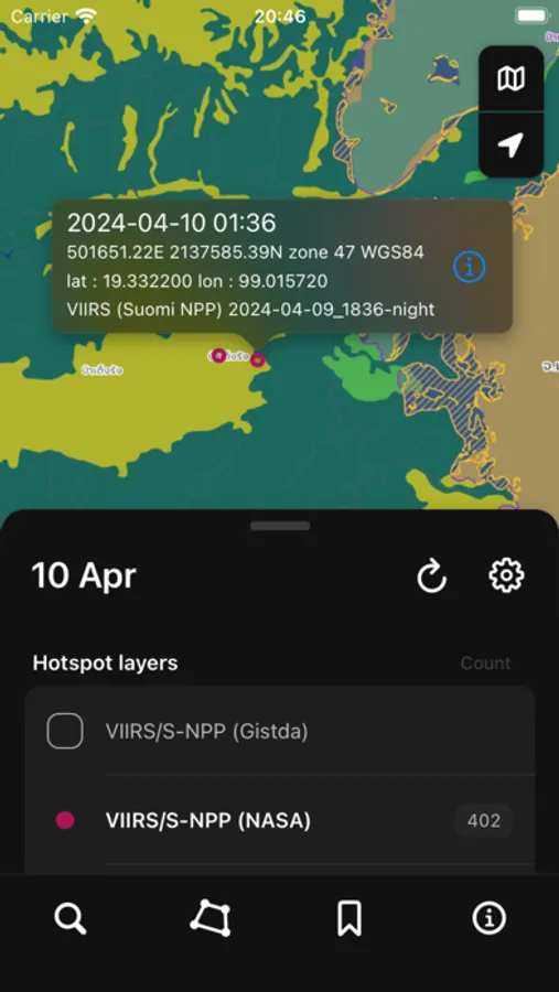
The application displays hotspots and related data layers, helping agencies plan and manage forest fires at both policy and operational levels. This development builds on a research project the Developing Geospatial Innovation for Thailand Forest Fire Clustering
and Spread Prediction from Hotspot Analysis. By the Department of National Parks, Wildlife and Plant Conservation, in collaboration with the Geo-Informatics and Space Technology Development Agency (Public Organization) (GISTDA).
Developed by Natthanon CHAIYASAK,
Chief of The Nakhon Sawan Forest Fire Control Station
Department of National Parks, Wildlife and Plant Conservation.