RFSBuddy
Volunteer Technology Services Australia Ltd
1.0 ★
store rating
Free
AppRecs review analysis
AppRecs rating 1.0. Trustworthiness 65 out of 100. Review manipulation risk 30 out of 100. Based on a review sample analyzed.
★☆☆☆☆
1.0
AppRecs Rating
Ratings breakdown
5 star
0%
4 star
0%
3 star
0%
2 star
0%
1 star
100%
What to know
✓
Low review manipulation risk
30% review manipulation risk
⚠
Mixed user feedback
Average 1.0★ rating suggests room for improvement
About RFSBuddy
GPS Mapping Co-ordinates - Record & Share, Field Notes, Movement Tracking & Handbook
FEATURES
• RFS Buddy works anywhere
• The RFS Buddy app does not need wifi or any phone carrier’s reception to work.
• RFS Buddy works directly from the iPhone’s internal GPS.
• Easily share your location with others via email. (Requires subscription)
• Simple "one click" to start tracking your movement. (Requires subscription)
• "Add Bearing" tool with camera zoom. With 2 or more Bearings you can triangulate the position of a point of interest in the distance, e.g. Smoke Sighting.
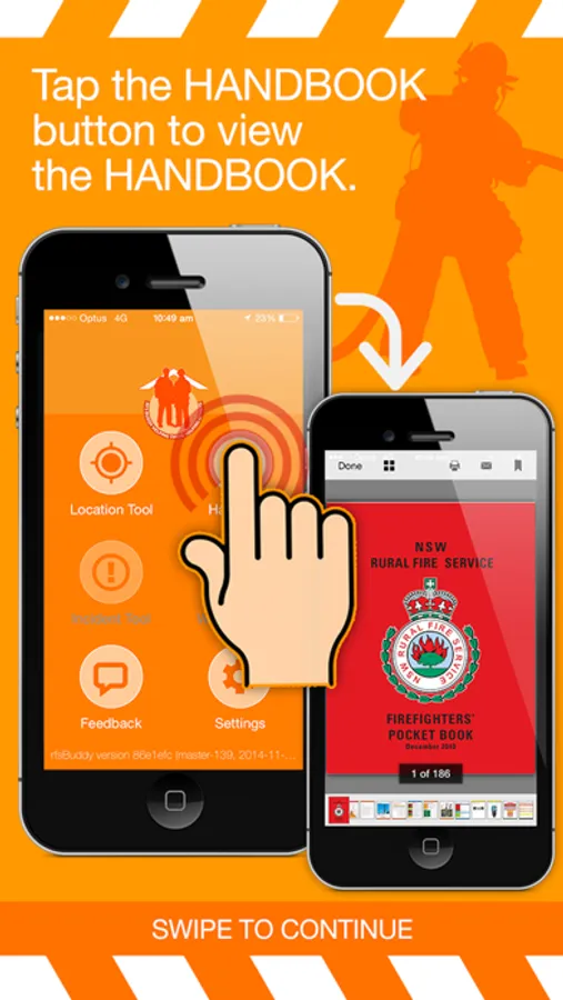
Developed to assist Australian volunteer Bushfire Fighters from the NSW Rural Fire Service (RFS), and also anyone that need GPS location services.
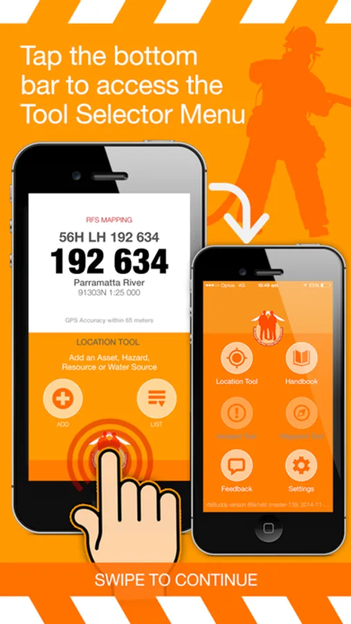
RFS Buddy translates your GPS location into the main RFS MGRS standard, including the LPI Map name and number. Also includes a number of other formats, and a Fire-ground Field Notes feature to record reference points of interest such as hazards, smoke etc.
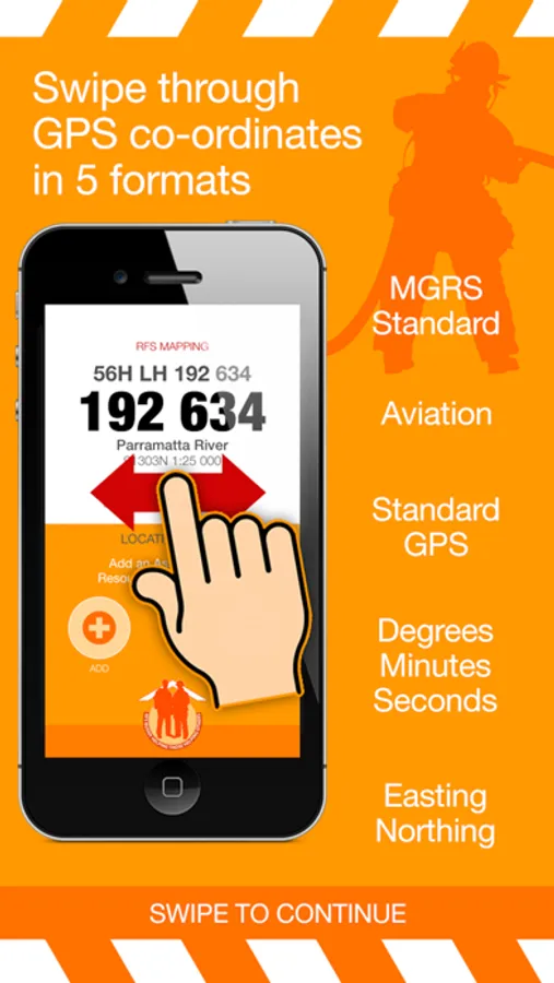
GPS CO-ORDINATES IN 5 FORMATS
1. RFS Mapping
The Standard MGRS format used to match the RFS maps used in the field. Includes:
- Full RFS Grid Reference (100m).
- Short RFS Grid Reference
- LPI Map Name, Reference Number & Scale
- GPS Accuracy
2. Aviation
3. Standard GPS
4. Degrees, Minutes, Seconds
5. Easting Northing
6. What3Words (NEW)
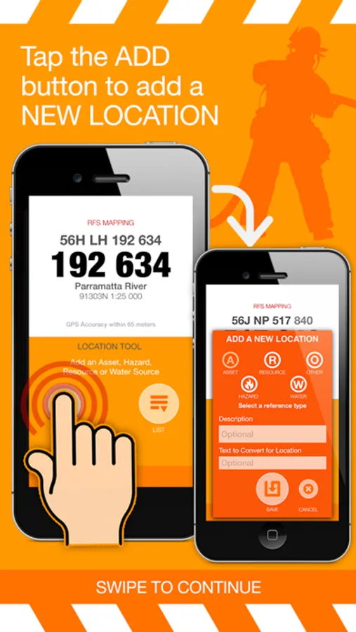
FIELD NOTES
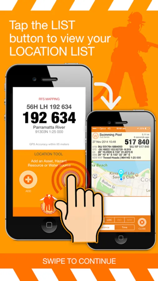
Name and record your current position in a list that (on swipe right) shows all 5 GPS formats.
- Ability to Select Location Reference Type Icon.
- Text to Convert for Location feature.
Convert a Grid Reference into Lat-Long or Lat-Long into Grid easily, quickly and accurately – and immediately check it on the included map for confirmation.
- Share / Publish location to your preferred setting of either State, District or Brigade. (required in-app subscription)
- Saved Locations now expand to show all Lat/Long formats plus map.
For more information, see Apple's standard Terms of use https://www.apple.com/legal/internet-services/itunes/dev/stdeula/ and our Privacy Policy https://vtsa.org.au/rfsbuddy-privacy-policy/
FEATURES
• RFS Buddy works anywhere
• The RFS Buddy app does not need wifi or any phone carrier’s reception to work.
• RFS Buddy works directly from the iPhone’s internal GPS.
• Easily share your location with others via email. (Requires subscription)
• Simple "one click" to start tracking your movement. (Requires subscription)
• "Add Bearing" tool with camera zoom. With 2 or more Bearings you can triangulate the position of a point of interest in the distance, e.g. Smoke Sighting.
Developed to assist Australian volunteer Bushfire Fighters from the NSW Rural Fire Service (RFS), and also anyone that need GPS location services.
RFS Buddy translates your GPS location into the main RFS MGRS standard, including the LPI Map name and number. Also includes a number of other formats, and a Fire-ground Field Notes feature to record reference points of interest such as hazards, smoke etc.
GPS CO-ORDINATES IN 5 FORMATS
1. RFS Mapping
The Standard MGRS format used to match the RFS maps used in the field. Includes:
- Full RFS Grid Reference (100m).
- Short RFS Grid Reference
- LPI Map Name, Reference Number & Scale
- GPS Accuracy
2. Aviation
3. Standard GPS
4. Degrees, Minutes, Seconds
5. Easting Northing
6. What3Words (NEW)
FIELD NOTES
Name and record your current position in a list that (on swipe right) shows all 5 GPS formats.
- Ability to Select Location Reference Type Icon.
- Text to Convert for Location feature.
Convert a Grid Reference into Lat-Long or Lat-Long into Grid easily, quickly and accurately – and immediately check it on the included map for confirmation.
- Share / Publish location to your preferred setting of either State, District or Brigade. (required in-app subscription)
- Saved Locations now expand to show all Lat/Long formats plus map.
For more information, see Apple's standard Terms of use https://www.apple.com/legal/internet-services/itunes/dev/stdeula/ and our Privacy Policy https://vtsa.org.au/rfsbuddy-privacy-policy/