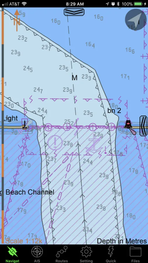
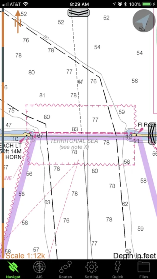
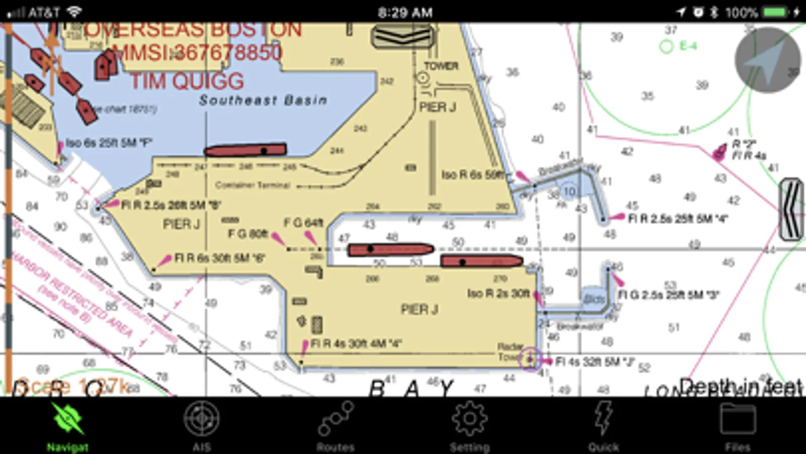
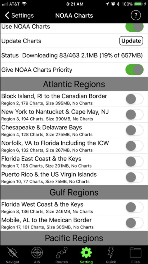
With this navigation app, you can view marine charts in formats like S-57, S-63, iENC, and BSB/KAP and connect to external NMEA/AIS devices over WiFi. Includes chart display adhering to IHO standards, vessel tracking features, and support for AIS playback.
AppRecs review analysis
AppRecs rating 4.4. Trustworthiness 0 out of 100. Review manipulation risk 0 out of 100. Based on a review sample analyzed.
★★★★☆
4.4
AppRecs Rating
Ratings breakdown
5 star
95%
4 star
2%
3 star
0%
2 star
0%
1 star
3%
What to know
✓
High user satisfaction
95% of sampled ratings are 5 stars
✓
Authentic reviews
No red flags detected
About SEAiq Pilot VPP
SEAiq Pilot VPP is designed especially for use by river, channel, and harbor pilots. It includes support for displaying charts in the S-57, S-63, iENC, and BSB/KAP formats and use of external NMEA/AIS over WiFi.
IMPORTANT: you can try all the features in SEAiq Pilot VPP by downloading our other app, SEAiq Pilot, which is the same app but with a 7-day evaluation period. For non-pilots, we recommend SEAiq and SEAiq USA.
Features unique to SEAiq Pilot include:
* Support for official HO S-57/S-63 marine charts
* Adheres to IHO S-52 chart display standards
* Predicted vessel display (with ROT)
* Docking aids displaying distance/velocity to wharf fenders
* Vessel catalog
* Supports WiFi based AIS plugs and Portable Pilot Units
* NMEA/AIS record and playback
* Waypoints, routes, ETA, XTD, speed limits
* Route Meeting Point
* Visual CPA
* AIS "virtual boarding"
* Mariners tools: VRM, EBL, Mariners Notes, Clearing Lines
Continued use of GPS running in the background can dramatically decrease battery life.