With this wildfire map app, you can view current fire detections, weather outlooks, and hazard zones. Includes satellite imagery, fire reports, weather indices, and drought data.
AppRecs review analysis
AppRecs rating 3.9. Trustworthiness 82 out of 100. Review manipulation risk 21 out of 100. Based on a review sample analyzed.
★★★☆☆
3.9
AppRecs Rating
Ratings breakdown
5 star
72%
4 star
13%
3 star
5%
2 star
2%
1 star
7%
What to know
✓
Low review manipulation risk
21% review manipulation risk
✓
Credible reviews
82% trustworthiness score from analyzed reviews
✓
High user satisfaction
85% of sampled ratings are 4+ stars (4.4★ average)
About Wildfire - Fire Map Info
Download the most comprehensive Wildfire app for iOS.
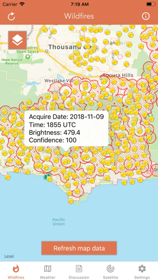
CURRENT WILDFIRES
- MODIS Thermal Satellite Fire Detection
- VIIRS IBAND Fire Detection
- MODIS + VIIRS Spot Details
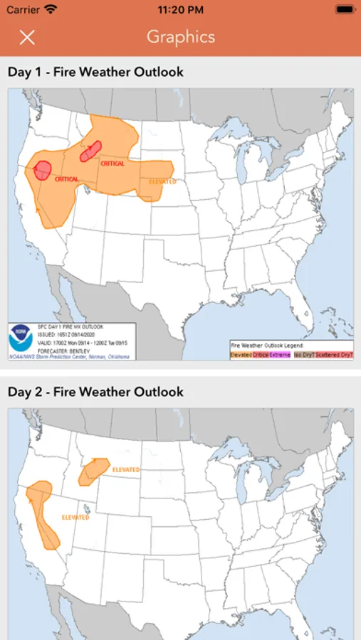
- Fire Weather Outlook: Days 1 - 8
- Large Fire Points
- Dry Thunderstorm Fire Weather Outlook
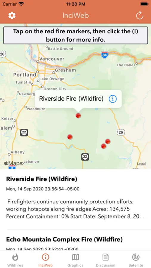
- National Fire Incident Reports
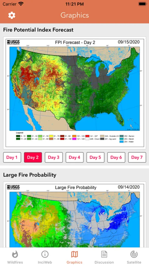
- Fire Potential Index: 7-day Forecast
- Large Fire Probability
- Fire Danger Rating
- Expected Large Fires per PSA
- National Significant Fire Outlook: 4-months
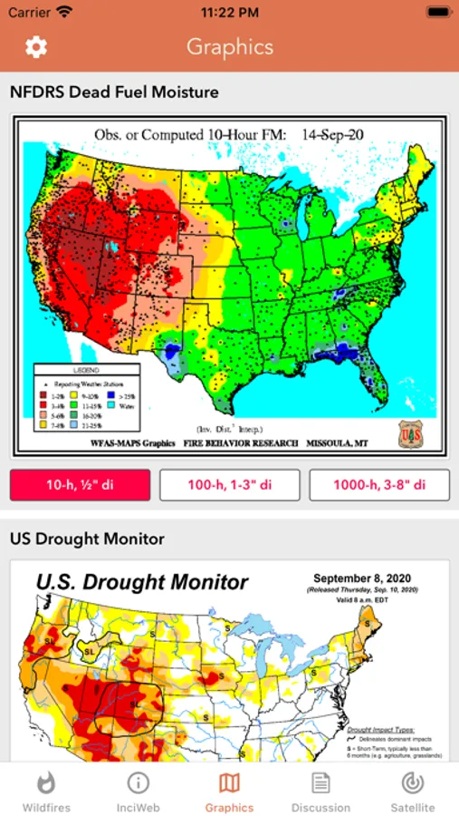
- NFDRS Dead Fuel Moisture
- US Drought Monitor & Index
HAZARDOUS WILDFIRE CONDITION ZONES
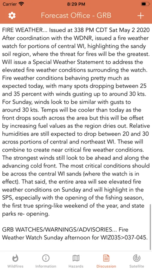
- Detailed NOAA discussion
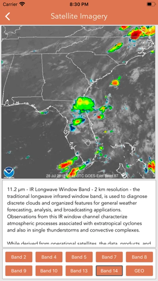
GOES-16 SATELLITE IMAGERY ANIMATIONS
- Regional zones (CONUS)
* Available for iPhone and iPad with single purchase *
Feel free to contact me at mwnbdc@gmail.com if you have any questions.
Enjoy.
CURRENT WILDFIRES
- MODIS Thermal Satellite Fire Detection
- VIIRS IBAND Fire Detection
- MODIS + VIIRS Spot Details
- Fire Weather Outlook: Days 1 - 8
- Large Fire Points
- Dry Thunderstorm Fire Weather Outlook
- National Fire Incident Reports
- Fire Potential Index: 7-day Forecast
- Large Fire Probability
- Fire Danger Rating
- Expected Large Fires per PSA
- National Significant Fire Outlook: 4-months
- NFDRS Dead Fuel Moisture
- US Drought Monitor & Index
HAZARDOUS WILDFIRE CONDITION ZONES
- Detailed NOAA discussion
GOES-16 SATELLITE IMAGERY ANIMATIONS
- Regional zones (CONUS)
* Available for iPhone and iPad with single purchase *
Feel free to contact me at mwnbdc@gmail.com if you have any questions.
Enjoy.