Fly Local
Studio BabDreams
Free
About Fly Local
Compute a safe altitude for your glider plane on a local flight.
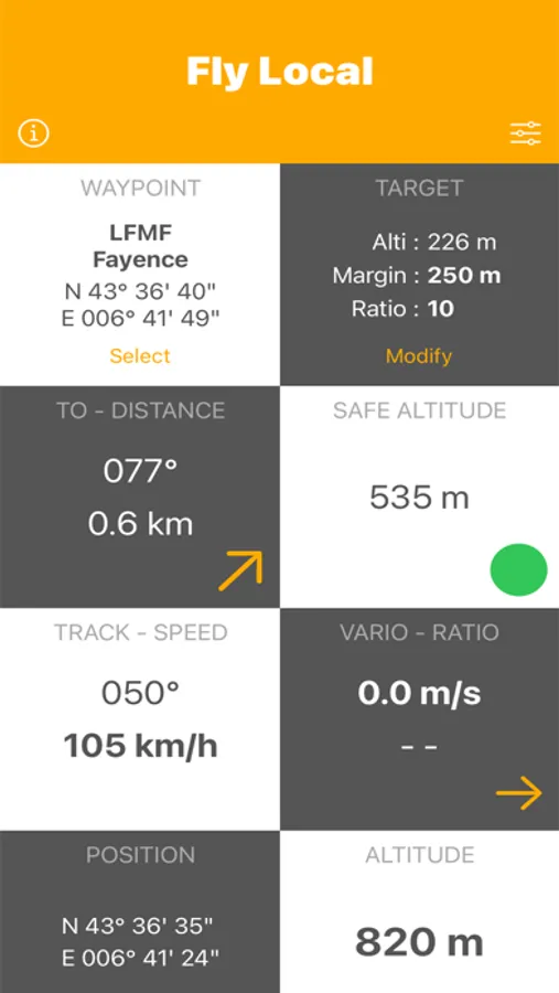
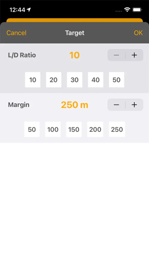
The app uses the GPS to display your relative position to an airfield and compute a safe glide altitude according to the selected L/D ratio.
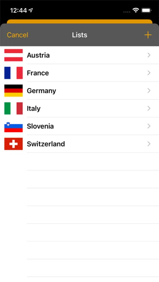
Database includes airflieds of the following countries : Austria, France, Germany, Italy, Slovenia and Switzerland.
Require iPhone or iPad with GPS.
Include Apple Watch app (models with GPS).
CAUTION : The app does not monitor the terrain clearance, but only glide angle.
The app uses the GPS to display your relative position to an airfield and compute a safe glide altitude according to the selected L/D ratio.
Database includes airflieds of the following countries : Austria, France, Germany, Italy, Slovenia and Switzerland.
Require iPhone or iPad with GPS.
Include Apple Watch app (models with GPS).
CAUTION : The app does not monitor the terrain clearance, but only glide angle.